Distance from Iba to Samal
Distance between Iba and Samal is 87 kilometers (54 miles).
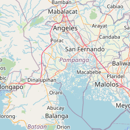
Driving distance from Iba to Samal is 119 kilometers (74 miles).
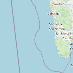
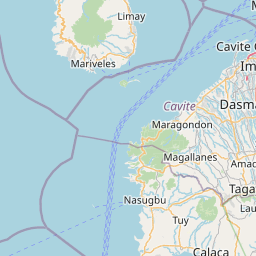
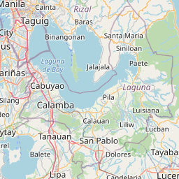
Distance Map Between Iba and Samal
Iba, , Philippines ↔ Samal, , Philippines = 54 miles = 87 km.


How far is it between Iba and Samal
Iba is located in Philippines with (15.3276,119.978) coordinates and Samal is located in Philippines with (14.7678,120.5431) coordinates. The calculated flying distance from Iba to Samal is equal to 54 miles which is equal to 87 km.
If you want to go by car, the driving distance between Iba and Samal is 118.87 km. If you ride your car with an average speed of 112 kilometers/hour (70 miles/h), travel time will be 01 hours 03 minutes. Please check the avg. speed travel time table on the right for various options.
Difference between fly and go by a car is 32 km.
| City/Place | Latitude and Longitude | GPS Coordinates |
|---|---|---|
| Iba | 15.3276, 119.978 | 15° 19´ 39.3600'' N 119° 58´ 40.8000'' E |
| Samal | 14.7678, 120.5431 | 14° 46´ 4.0080'' N 120° 32´ 35.0160'' E |
Estimated Travel Time Between Iba and Samal
| Average Speed | Travel Time |
|---|---|
| 30 mph (48 km/h) | 02 hours 28 minutes |
| 40 mph (64 km/h) | 01 hours 51 minutes |
| 50 mph (80 km/h) | 01 hours 29 minutes |
| 60 mph (97 km/h) | 01 hours 13 minutes |
| 70 mph (112 km/h) | 01 hours 03 minutes |
| 75 mph (120 km/h) | 00 hours 59 minutes |
Related Distances from Iba
| Cities | Distance |
|---|---|
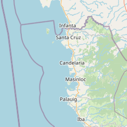
| Iba to Masinloc | 28 km |
| Iba to Olongapo | 80 km |
| Iba to San Narciso | 42 km |
| Iba to Subic | 67 km |
| Iba to Santa Cruz 5 | 57 km |
Related Distances to Samal
| Cities | Distance |
|---|---|
| Balanga to Samal 2 | 11 km |
| Orani to Samal 2 | 4 km |
| Limay to Samal 2 | 32 km |
| Orion to Samal 2 | 19 km |
| Mariveles to Samal 2 | 61 km |