Distance from Ieper to Oostkamp
Distance between Ieper and Oostkamp is 41 kilometers (26 miles).
Driving distance from Ieper to Oostkamp is 69 kilometers (43 miles).
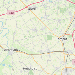
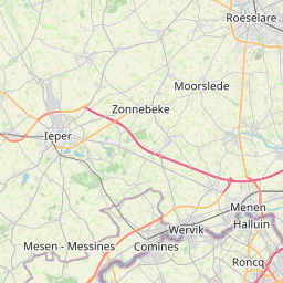
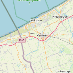
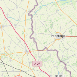
Distance Map Between Ieper and Oostkamp
Ieper, , Belgium ↔ Oostkamp, , Belgium = 26 miles = 41 km.


How far is it between Ieper and Oostkamp
Ieper is located in Belgium with (50.8511,2.8857) coordinates and Oostkamp is located in Belgium with (51.1543,3.2313) coordinates. The calculated flying distance from Ieper to Oostkamp is equal to 26 miles which is equal to 41 km.
If you want to go by car, the driving distance between Ieper and Oostkamp is 69.03 km. If you ride your car with an average speed of 112 kilometers/hour (70 miles/h), travel time will be 00 hours 36 minutes. Please check the avg. speed travel time table on the right for various options.
Difference between fly and go by a car is 28 km.
| City/Place | Latitude and Longitude | GPS Coordinates |
|---|---|---|
| Ieper | 50.8511, 2.8857 | 50° 51´ 4.1040'' N 2° 53´ 8.4840'' E |
| Oostkamp | 51.1543, 3.2313 | 51° 9´ 15.5520'' N 3° 13´ 52.6080'' E |
Estimated Travel Time Between Ieper and Oostkamp
| Average Speed | Travel Time |
|---|---|
| 30 mph (48 km/h) | 01 hours 26 minutes |
| 40 mph (64 km/h) | 01 hours 04 minutes |
| 50 mph (80 km/h) | 00 hours 51 minutes |
| 60 mph (97 km/h) | 00 hours 42 minutes |
| 70 mph (112 km/h) | 00 hours 36 minutes |
| 75 mph (120 km/h) | 00 hours 34 minutes |
Related Distances from Ieper
| Cities | Distance |
|---|---|
| Ieper to Izegem | 39 km |
| Ieper to Kalmthout | 161 km |
| Ieper to Kapellen | 148 km |
| Ieper to Knokke Heist | 91 km |
| Ieper to Koksijde | 37 km |
| Ieper to Kontich | 138 km |
| Ieper to Kortrijk | 34 km |
| Ieper to Lanaken | 231 km |
| Ieper to Lebbeke | 109 km |
| Ieper to Lede | 97 km |
Related Distances to Oostkamp
| Cities | Distance |
|---|---|
| Kapellen to Oostkamp | 113 km |
| Koksijde to Oostkamp | 55 km |
| Izegem to Oostkamp | 37 km |
| Brugge to Oostkamp | 7 km |
| Lede to Oostkamp | 64 km |
| Menen to Oostkamp | 52 km |
| Diksmuide to Oostkamp | 43 km |
| Ostend to Oostkamp | 24 km |
| Geraardsbergen to Oostkamp | 73 km |
| Harelbeke to Oostkamp | 55 km |