Distance from Ilha de Mocambique to Antonio Enes
Distance between Ilha de Mocambique and Antonio Enes is 160 kilometers (99 miles).
Driving distance from Ilha de Mocambique to Antonio Enes is 224 kilometers (139 miles).
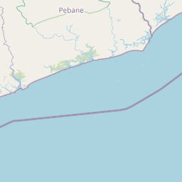
Distance Map Between Ilha de Mocambique and Antonio Enes
Ilha de Mocambique, Nampula, Mozambique ↔ Antonio Enes, Nampula, Mozambique = 99 miles = 160 km.


How far is it between Ilha de Moçambique and António Enes
Ilha de Mocambique is located in Mozambique with (-15.0342,40.7358) coordinates and Antonio Enes is located in Mozambique with (-16.2325,39.9086) coordinates. The calculated flying distance from Ilha de Mocambique to Antonio Enes is equal to 99 miles which is equal to 160 km.
If you want to go by car, the driving distance between Ilha de Mocambique and Antonio Enes is 223.52 km. If you ride your car with an average speed of 112 kilometers/hour (70 miles/h), travel time will be 01 hours 59 minutes. Please check the avg. speed travel time table on the right for various options.
Difference between fly and go by a car is 64 km.
| City/Place | Latitude and Longitude | GPS Coordinates |
|---|---|---|
| Ilha de Mocambique | -15.0342, 40.7358 | 15° 2´ 3.0120'' S 40° 44´ 8.9880'' E |
| Antonio Enes | -16.2325, 39.9086 | 16° 13´ 57.0000'' S 39° 54´ 30.9960'' E |
Estimated Travel Time Between Ilha de Moçambique and António Enes
| Average Speed | Travel Time |
|---|---|
| 30 mph (48 km/h) | 04 hours 39 minutes |
| 40 mph (64 km/h) | 03 hours 29 minutes |
| 50 mph (80 km/h) | 02 hours 47 minutes |
| 60 mph (97 km/h) | 02 hours 18 minutes |
| 70 mph (112 km/h) | 01 hours 59 minutes |
| 75 mph (120 km/h) | 01 hours 51 minutes |
Related Distances from Ilha de Mocambique
| Cities | Distance |
|---|---|
| Ilha De Mocambique to Antonio Enes | 224 km |
| Ilha De Mocambique to Nacala | 116 km |
| Ilha De Mocambique to Mutuali | 482 km |
Related Distances to Antonio Enes
| Cities | Distance |
|---|---|
| Ilha De Mocambique to Antonio Enes | 224 km |
| Mutuali to Antonio Enes | 468 km |
| Nacala to Antonio Enes | 236 km |