Distance from Indianapolis to Welland
Distance between Indianapolis and Welland is 678 kilometers (421 miles).
Driving distance from Indianapolis to Welland is 848 kilometers (527 miles).
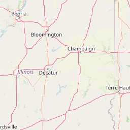
Distance Map Between Indianapolis and Welland
Indianapolis, United States ↔ Welland, Ontario, Canada = 421 miles = 678 km.


How far is it between Indianapolis and Welland
Indianapolis is located in United States with (39.7684,-86.158) coordinates and Welland is located in Canada with (42.9834,-79.2496) coordinates. The calculated flying distance from Indianapolis to Welland is equal to 421 miles which is equal to 678 km.
If you want to go by car, the driving distance between Indianapolis and Welland is 847.85 km. If you ride your car with an average speed of 112 kilometers/hour (70 miles/h), travel time will be 07 hours 34 minutes. Please check the avg. speed travel time table on the right for various options.
Difference between fly and go by a car is 170 km.
| City/Place | Latitude and Longitude | GPS Coordinates |
|---|---|---|
| Indianapolis | 39.7684, -86.158 | 39° 46´ 6.1680'' N 86° 9´ 28.9440'' W |
| Welland | 42.9834, -79.2496 | 42° 59´ 0.3120'' N 79° 14´ 58.4880'' W |
Estimated Travel Time Between Indianapolis and Welland
| Average Speed | Travel Time |
|---|---|
| 30 mph (48 km/h) | 17 hours 39 minutes |
| 40 mph (64 km/h) | 13 hours 14 minutes |
| 50 mph (80 km/h) | 10 hours 35 minutes |
| 60 mph (97 km/h) | 08 hours 44 minutes |
| 70 mph (112 km/h) | 07 hours 34 minutes |
| 75 mph (120 km/h) | 07 hours 03 minutes |
Related Distances from Indianapolis
| Cities | Distance |
|---|---|
| Indianapolis to Toronto | 828 km |
| Indianapolis to Niagara Falls | 848 km |
| Indianapolis to Hamilton | 767 km |
| Indianapolis to Montreal | 1359 km |
| Indianapolis to Sault Ste Marie | 873 km |
Related Distances to Welland
| Cities | Distance |
|---|---|
| New York City to Welland | 638 km |
| Baltimore to Welland | 617 km |
| Philadelphia to Welland | 648 km |
| Chicago to Welland | 851 km |
| Boston to Welland | 773 km |