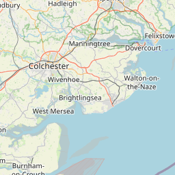
Distance from Ipswich to Luton
Distance between Ipswich and Luton is 110 kilometers (68 miles).
Driving distance from Ipswich to Luton is 147 kilometers (91 miles).
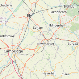
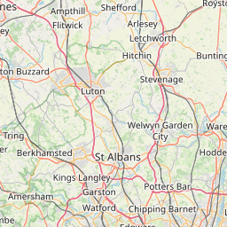
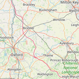
Distance Map Between Ipswich and Luton
Ipswich, London, United Kingdom ↔ Luton, London, United Kingdom = 68 miles = 110 km.


How far is it between Ipswich and Luton
Ipswich is located in United Kingdom with (52.0592,1.1555) coordinates and Luton is located in United Kingdom with (51.8797,-0.4175) coordinates. The calculated flying distance from Ipswich to Luton is equal to 68 miles which is equal to 110 km.
If you want to go by car, the driving distance between Ipswich and Luton is 147.03 km. If you ride your car with an average speed of 112 kilometers/hour (70 miles/h), travel time will be 01 hours 18 minutes. Please check the avg. speed travel time table on the right for various options.
Difference between fly and go by a car is 37 km.
| City/Place | Latitude and Longitude | GPS Coordinates |
|---|---|---|
| Ipswich | 52.0592, 1.1555 | 52° 3´ 33.0120'' N 1° 9´ 19.6200'' E |
| Luton | 51.8797, -0.4175 | 51° 52´ 46.8120'' N 0° 25´ 2.9280'' W |
Estimated Travel Time Between Ipswich and Luton
| Average Speed | Travel Time |
|---|---|
| 30 mph (48 km/h) | 03 hours 03 minutes |
| 40 mph (64 km/h) | 02 hours 17 minutes |
| 50 mph (80 km/h) | 01 hours 50 minutes |
| 60 mph (97 km/h) | 01 hours 30 minutes |
| 70 mph (112 km/h) | 01 hours 18 minutes |
| 75 mph (120 km/h) | 01 hours 13 minutes |
Related Distances from Ipswich
| Cities | Distance |
|---|---|
| Ipswich to Norwich | 72 km |
| Ipswich to City Of London | 131 km |
| Ipswich to Manchester | 375 km |
| Ipswich to Liverpool | 392 km |
| Ipswich to Lincoln 2 | 241 km |
Related Distances to Luton
| Cities | Distance |
|---|---|
| London to LUTON | 56 km |
| Birmingham to Luton | 141 km |
| Cambridge to Luton | 64 km |
| Liverpool to Luton | 290 km |
| City Of London to Luton | 56 km |