Distance from Istra to Lodz
Distance between Istra and Lodz is 1228 kilometers (763 miles).
Driving distance from Istra to Lodz is 1355 kilometers (842 miles).
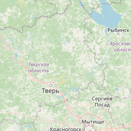
Distance Map Between Istra and Lodz
Istra, Vostochnoe Degunino, Russia ↔ Lodz, Poland = 763 miles = 1228 km.


How far is it between Istra and Łódź
Istra is located in Russia with (55.92,36.8687) coordinates and Lodz is located in Poland with (51.75,19.4667) coordinates. The calculated flying distance from Istra to Lodz is equal to 763 miles which is equal to 1228 km.
If you want to go by car, the driving distance between Istra and Lodz is 1354.83 km. If you ride your car with an average speed of 112 kilometers/hour (70 miles/h), travel time will be 12 hours 05 minutes. Please check the avg. speed travel time table on the right for various options.
Difference between fly and go by a car is 127 km.
| City/Place | Latitude and Longitude | GPS Coordinates |
|---|---|---|
| Istra | 55.92, 36.8687 | 55° 55´ 11.8920'' N 36° 52´ 7.2120'' E |
| Lodz | 51.75, 19.4667 | 51° 45´ 0.0000'' N 19° 28´ 0.0120'' E |
Estimated Travel Time Between Istra and Łódź
| Average Speed | Travel Time |
|---|---|
| 30 mph (48 km/h) | 28 hours 13 minutes |
| 40 mph (64 km/h) | 21 hours 10 minutes |
| 50 mph (80 km/h) | 16 hours 56 minutes |
| 60 mph (97 km/h) | 13 hours 58 minutes |
| 70 mph (112 km/h) | 12 hours 05 minutes |
| 75 mph (120 km/h) | 11 hours 17 minutes |
Related Distances from Istra
| Cities | Distance |
|---|---|
| Istra to Krakow | 1501 km |
| Istra to Lodz | 1355 km |
| Istra to Warsaw | 1237 km |
Related Distances to Lodz
| Cities | Distance |
|---|---|
| Moscow to Lodz | 1379 km |
| Saint Petersburg to Lodz | 1303 km |
| Rostov to Lodz | 1598 km |
| Venev to Lodz | 1540 km |
| Pokrov to Lodz | 1500 km |