Distance from Jagdaqi to Salaqi
Distance between Jagdaqi and Salaqi is 1522 kilometers (946 miles).
Driving distance from Jagdaqi to Salaqi is 2357 kilometers (1465 miles).
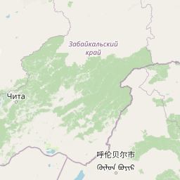
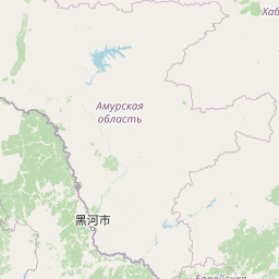
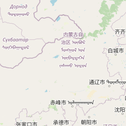
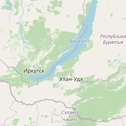
Distance Map Between Jagdaqi and Salaqi
Jagdaqi, Hohhot, China ↔ Salaqi, Hohhot, China = 946 miles = 1522 km.


How far is it between Jagdaqi and Salaqi
Jagdaqi is located in China with (50.4167,124.1167) coordinates and Salaqi is located in China with (40.5414,110.5108) coordinates. The calculated flying distance from Jagdaqi to Salaqi is equal to 946 miles which is equal to 1522 km.
If you want to go by car, the driving distance between Jagdaqi and Salaqi is 2356.91 km. If you ride your car with an average speed of 112 kilometers/hour (70 miles/h), travel time will be 21 hours 02 minutes. Please check the avg. speed travel time table on the right for various options.
Difference between fly and go by a car is 835 km.
| City/Place | Latitude and Longitude | GPS Coordinates |
|---|---|---|
| Jagdaqi | 50.4167, 124.1167 | 50° 25´ 0.0120'' N 124° 7´ 0.0120'' E |
| Salaqi | 40.5414, 110.5108 | 40° 32´ 29.0040'' N 110° 30´ 38.9880'' E |
Estimated Travel Time Between Jagdaqi and Salaqi
| Average Speed | Travel Time |
|---|---|
| 30 mph (48 km/h) | 49 hours 06 minutes |
| 40 mph (64 km/h) | 36 hours 49 minutes |
| 50 mph (80 km/h) | 29 hours 27 minutes |
| 60 mph (97 km/h) | 24 hours 17 minutes |
| 70 mph (112 km/h) | 21 hours 02 minutes |
| 75 mph (120 km/h) | 19 hours 38 minutes |
Related Distances from Jagdaqi
| Cities | Distance |
|---|---|
| Jagdaqi to Salaqi | 2357 km |
| Jagdaqi to Xilin Hot | 1467 km |
| Jagdaqi to Wuhai | 2789 km |
| Jagdaqi to Jining 2 | 2113 km |
| Jagdaqi to Ulanhot | 731 km |
Related Distances to Salaqi
| Cities | Distance |
|---|---|
| Jagdaqi to Salaqi | 2357 km |
| Chifeng to Salaqi | 962 km |
| Baotou to Salaqi | 85 km |
| Genhe to Salaqi | 2651 km |
| Manzhouli to Salaqi | 2595 km |