Distance from Jalor to Pali
Distance between Jalor and Pali is 85 kilometers (53 miles).
Driving distance from Jalor to Pali is 118 kilometers (73 miles).
Distance Map Between Jalor and Pali
Jalor, Jaipur, India ↔ Pali, Jaipur, India = 53 miles = 85 km.


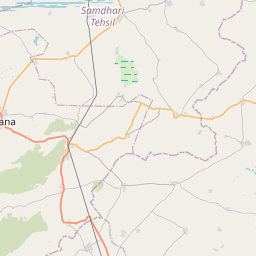


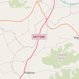


Leaflet | © OpenStreetMap
How far is it between Jalor and Pāli
Jalor is located in India with (25.3456,72.6156) coordinates and Pali is located in India with (25.7728,73.3234) coordinates. The calculated flying distance from Jalor to Pali is equal to 53 miles which is equal to 85 km.
If you want to go by car, the driving distance between Jalor and Pali is 118.18 km. If you ride your car with an average speed of 112 kilometers/hour (70 miles/h), travel time will be 01 hours 03 minutes. Please check the avg. speed travel time table on the right for various options.
Difference between fly and go by a car is 33 km.
| City/Place | Latitude and Longitude | GPS Coordinates |
|---|---|---|
| Jalor | 25.3456, 72.6156 | 25° 20´ 44.0880'' N 72° 36´ 56.1240'' E |
| Pali | 25.7728, 73.3234 | 25° 46´ 21.9360'' N 73° 19´ 24.0600'' E |
Estimated Travel Time Between Jalor and Pāli
| Average Speed | Travel Time |
|---|---|
| 30 mph (48 km/h) | 02 hours 27 minutes |
| 40 mph (64 km/h) | 01 hours 50 minutes |
| 50 mph (80 km/h) | 01 hours 28 minutes |
| 60 mph (97 km/h) | 01 hours 13 minutes |
| 70 mph (112 km/h) | 01 hours 03 minutes |
| 75 mph (120 km/h) | 00 hours 59 minutes |
Jalor, Jaipur, India
Related Distances from Jalor
| Cities | Distance |
|---|---|
| Jalor to Sambhar | 370 km |
| Jalor to Neem Ka Thana | 531 km |
| Jalor to Sikar | 456 km |
| Jalor to Udaipur | 206 km |
| Jalor to Pratapgarh | 369 km |
Pali, Jaipur, India
Related Distances to Pali
| Cities | Distance |
|---|---|
| Lakhimpur to Palia Kalan | 75 km |
| Bareilly to Palia Kalan | 159 km |
| Jaitaran to Pali | 86 km |
| Gola Gokarannath to Palia Kalan | 69 km |
| Bali 3 to Pali | 76 km |