Distance from Jamtara to Katras
Distance between Jamtara and Katras is 54 kilometers (34 miles).
Driving distance from Jamtara to Katras is 102 kilometers (63 miles).
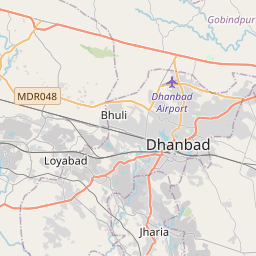
Distance Map Between Jamtara and Katras
Jamtara, Ranchi, India ↔ Katras, Ranchi, India = 34 miles = 54 km.


How far is it between Jāmtāra and Kātrās
Jamtara is located in India with (23.963,86.8029) coordinates and Katras is located in India with (23.7975,86.2983) coordinates. The calculated flying distance from Jamtara to Katras is equal to 34 miles which is equal to 54 km.
If you want to go by car, the driving distance between Jamtara and Katras is 102.14 km. If you ride your car with an average speed of 112 kilometers/hour (70 miles/h), travel time will be 00 hours 54 minutes. Please check the avg. speed travel time table on the right for various options.
Difference between fly and go by a car is 48 km.
| City/Place | Latitude and Longitude | GPS Coordinates |
|---|---|---|
| Jamtara | 23.963, 86.8029 | 23° 57´ 46.8000'' N 86° 48´ 10.2600'' E |
| Katras | 23.7975, 86.2983 | 23° 47´ 51.0720'' N 86° 17´ 54.0240'' E |
Estimated Travel Time Between Jāmtāra and Kātrās
| Average Speed | Travel Time |
|---|---|
| 30 mph (48 km/h) | 02 hours 07 minutes |
| 40 mph (64 km/h) | 01 hours 35 minutes |
| 50 mph (80 km/h) | 01 hours 16 minutes |
| 60 mph (97 km/h) | 01 hours 03 minutes |
| 70 mph (112 km/h) | 00 hours 54 minutes |
| 75 mph (120 km/h) | 00 hours 51 minutes |
Related Distances from Jamtara
| Cities | Distance |
|---|---|
| Jamtara to Sahibganj | 225 km |
| Jamtara to Ramgarh | 208 km |
| Jamtara to Jharia | 95 km |
| Jamtara to Kodarma | 173 km |
| Jamtara to Madhupur | 59 km |
Related Distances to Katras
| Cities | Distance |
|---|---|
| Dhanbad to Katras | 20 km |
| Gomoh to Katras | 23 km |
| Bokaro to Katras | 47 km |
| Giridih to Katras | 94 km |
| Jharia to Katras | 19 km |