Distance from Jiutai to Meihekou
Distance between Jiutai and Meihekou is 181 kilometers (113 miles).
Driving distance from Jiutai to Meihekou is 233 kilometers (145 miles).
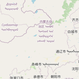
Distance Map Between Jiutai and Meihekou
Jiutai, Changchun, China ↔ Meihekou, Changchun, China = 113 miles = 181 km.


How far is it between Jiutai and Meihekou
Jiutai is located in China with (44.1525,125.8328) coordinates and Meihekou is located in China with (42.5272,125.6753) coordinates. The calculated flying distance from Jiutai to Meihekou is equal to 113 miles which is equal to 181 km.
If you want to go by car, the driving distance between Jiutai and Meihekou is 232.71 km. If you ride your car with an average speed of 112 kilometers/hour (70 miles/h), travel time will be 02 hours 04 minutes. Please check the avg. speed travel time table on the right for various options.
Difference between fly and go by a car is 52 km.
| City/Place | Latitude and Longitude | GPS Coordinates |
|---|---|---|
| Jiutai | 44.1525, 125.8328 | 44° 9´ 9.0000'' N 125° 49´ 58.0080'' E |
| Meihekou | 42.5272, 125.6753 | 42° 31´ 37.9920'' N 125° 40´ 31.0080'' E |
Estimated Travel Time Between Jiutai and Meihekou
| Average Speed | Travel Time |
|---|---|
| 30 mph (48 km/h) | 04 hours 50 minutes |
| 40 mph (64 km/h) | 03 hours 38 minutes |
| 50 mph (80 km/h) | 02 hours 54 minutes |
| 60 mph (97 km/h) | 02 hours 23 minutes |
| 70 mph (112 km/h) | 02 hours 04 minutes |
| 75 mph (120 km/h) | 01 hours 56 minutes |
Related Distances from Jiutai
| Cities | Distance |
|---|---|
| Jiutai to Meihekou | 233 km |
| Jiutai to Yushu | 103 km |
| Jiutai to Songjianghe | 373 km |
| Jiutai to Yanji | 394 km |
| Jiutai to Shuangyang | 107 km |
Related Distances to Meihekou
| Cities | Distance |
|---|---|
| Jilin to Meihekou | 182 km |
| Jiutai to Meihekou | 233 km |
| Dongfeng to Meihekou | 29 km |
| Hunchun to Meihekou | 581 km |
| Changling to Meihekou | 307 km |