Distance from Joetsu to Sanjo
Distance between Joetsu and Sanjo is 82 kilometers (51 miles).
Driving distance from Joetsu to Sanjo is 94 kilometers (59 miles).
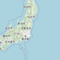
Distance Map Between Joetsu and Sanjo
Joetsu, Niigata-shi, Japan ↔ Sanjo, Niigata-shi, Japan = 51 miles = 82 km.

How far is it between Jōetsu and Sanjō
Joetsu is located in Japan with (37.1483,138.2364) coordinates and Sanjo is located in Japan with (37.6167,138.95) coordinates. The calculated flying distance from Joetsu to Sanjo is equal to 51 miles which is equal to 82 km.
If you want to go by car, the driving distance between Joetsu and Sanjo is 94.22 km. If you ride your car with an average speed of 112 kilometers/hour (70 miles/h), travel time will be 00 hours 50 minutes. Please check the avg. speed travel time table on the right for various options.
Difference between fly and go by a car is 12 km.
| City/Place | Latitude and Longitude | GPS Coordinates |
|---|---|---|
| Joetsu | 37.1483, 138.2364 | 37° 8´ 53.8080'' N 138° 14´ 11.1120'' E |
| Sanjo | 37.6167, 138.95 | 37° 37´ 0.0120'' N 138° 56´ 60.0000'' E |
Estimated Travel Time Between Jōetsu and Sanjō
| Average Speed | Travel Time |
|---|---|
| 30 mph (48 km/h) | 01 hours 57 minutes |
| 40 mph (64 km/h) | 01 hours 28 minutes |
| 50 mph (80 km/h) | 01 hours 10 minutes |
| 60 mph (97 km/h) | 00 hours 58 minutes |
| 70 mph (112 km/h) | 00 hours 50 minutes |
| 75 mph (120 km/h) | 00 hours 47 minutes |
Related Distances from Joetsu
| Cities | Distance |
|---|---|
| Joetsu to Nagaoka | 79 km |
| Joetsu to Murakami | 188 km |
| Joetsu to Itoigawa | 50 km |
| Joetsu to Muikamachi | 132 km |
| Joetsu to Tokamachi | 56 km |
Related Distances to Sanjo
| Cities | Distance |
|---|---|
| Maki to Sanjo | 22 km |
| Gosen to Sanjo | 31 km |
| Nagaoka to Sanjo | 27 km |
| Arai to Sanjo | 109 km |
| Ojiya to Sanjo | 45 km |