Distance from Kafue to Mansa
Distance between Kafue and Mansa is 514 kilometers (319 miles).
Driving distance from Kafue to Mansa is 807 kilometers (502 miles).
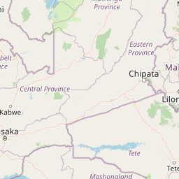
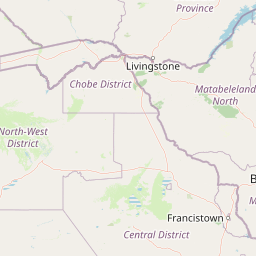
Distance Map Between Kafue and Mansa
Kafue, Lusaka, Zambia ↔ Mansa, Zambia = 319 miles = 514 km.

How far is it between Kafue and Mansa
Kafue is located in Zambia with (-15.7691,28.1814) coordinates and Mansa is located in Zambia with (-11.1998,28.8943) coordinates. The calculated flying distance from Kafue to Mansa is equal to 319 miles which is equal to 514 km.
If you want to go by car, the driving distance between Kafue and Mansa is 807.33 km. If you ride your car with an average speed of 112 kilometers/hour (70 miles/h), travel time will be 07 hours 12 minutes. Please check the avg. speed travel time table on the right for various options.
Difference between fly and go by a car is 293 km.
| City/Place | Latitude and Longitude | GPS Coordinates |
|---|---|---|
| Kafue | -15.7691, 28.1814 | 15° 46´ 8.7960'' S 28° 10´ 52.8960'' E |
| Mansa | -11.1998, 28.8943 | 11° 11´ 59.1360'' S 28° 53´ 39.5160'' E |
Estimated Travel Time Between Kafue and Mansa
| Average Speed | Travel Time |
|---|---|
| 30 mph (48 km/h) | 16 hours 49 minutes |
| 40 mph (64 km/h) | 12 hours 36 minutes |
| 50 mph (80 km/h) | 10 hours 05 minutes |
| 60 mph (97 km/h) | 08 hours 19 minutes |
| 70 mph (112 km/h) | 07 hours 12 minutes |
| 75 mph (120 km/h) | 06 hours 43 minutes |
Related Distances from Kafue
| Cities | Distance |
|---|---|
| Kafue to Lusaka | 46 km |
| Kafue to Livingstone | 430 km |
| Kafue to Ndola | 365 km |
| Kafue to Kasama | 903 km |
| Kafue to Mansa 2 | 807 km |
Related Distances to Mansa
| Cities | Distance |
|---|---|
| Lusaka to Mansa 2 | 757 km |
| Kasama to Mansa 2 | 343 km |
| Ndola to Mansa 2 | 245 km |
| Mufulira to Mansa 2 | 180 km |
| Kabwe to Mansa 2 | 619 km |