Distance from Kaka to Lahore
Distance between Kaka and Lahore is 1494 kilometers (928 miles).
Driving distance from Kaka to Lahore is 2182 kilometers (1356 miles).
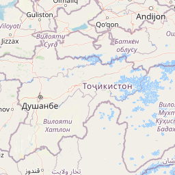
Distance Map Between Kaka and Lahore
Kaka, Ashgabat, Turkmenistan ↔ Lahore, Pakistan = 928 miles = 1494 km.


How far is it between Kaka and Lahore
Kaka is located in Turkmenistan with (37.3482,59.6143) coordinates and Lahore is located in Pakistan with (31.5497,74.3436) coordinates. The calculated flying distance from Kaka to Lahore is equal to 928 miles which is equal to 1494 km.
If you want to go by car, the driving distance between Kaka and Lahore is 2182.37 km. If you ride your car with an average speed of 112 kilometers/hour (70 miles/h), travel time will be 19 hours 29 minutes. Please check the avg. speed travel time table on the right for various options.
Difference between fly and go by a car is 688 km.
| City/Place | Latitude and Longitude | GPS Coordinates |
|---|---|---|
| Kaka | 37.3482, 59.6143 | 37° 20´ 53.5560'' N 59° 36´ 51.5160'' E |
| Lahore | 31.5497, 74.3436 | 31° 32´ 58.9920'' N 74° 20´ 36.9960'' E |
Estimated Travel Time Between Kaka and Lahore
| Average Speed | Travel Time |
|---|---|
| 30 mph (48 km/h) | 45 hours 27 minutes |
| 40 mph (64 km/h) | 34 hours 05 minutes |
| 50 mph (80 km/h) | 27 hours 16 minutes |
| 60 mph (97 km/h) | 22 hours 29 minutes |
| 70 mph (112 km/h) | 19 hours 29 minutes |
| 75 mph (120 km/h) | 18 hours 11 minutes |
Related Distances from Kaka
| Cities | Distance |
|---|---|
| Kaka to Lahore | 2182 km |
| Kaka to Karachi | 2062 km |
| Kaka to Rawalpindi | 1865 km |
| Kaka to Faisalabad | 2142 km |
Related Distances to Lahore
| Cities | Distance |
|---|---|
| Mary to Lahore | 1962 km |
| Ashgabat to Lahore | 2316 km |
| Kaka to Lahore | 2182 km |
| Tagta to Lahore | 2199 km |
| Turkmenabat to Lahore | 1675 km |