Distance from Kalmar to Koping
Distance between Kalmar and Koping is 318 kilometers (198 miles).
Driving distance from Kalmar to Koping is 371 kilometers (231 miles).
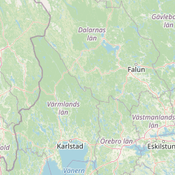
Distance Map Between Kalmar and Koping
Kalmar, Sweden ↔ Koping, Vasteras, Sweden = 198 miles = 318 km.


How far is it between Kalmar and Köping
Kalmar is located in Sweden with (56.6616,16.3616) coordinates and Koping is located in Sweden with (59.514,15.9926) coordinates. The calculated flying distance from Kalmar to Koping is equal to 198 miles which is equal to 318 km.
If you want to go by car, the driving distance between Kalmar and Koping is 371.08 km. If you ride your car with an average speed of 112 kilometers/hour (70 miles/h), travel time will be 03 hours 18 minutes. Please check the avg. speed travel time table on the right for various options.
Difference between fly and go by a car is 53 km.
| City/Place | Latitude and Longitude | GPS Coordinates |
|---|---|---|
| Kalmar | 56.6616, 16.3616 | 56° 39´ 41.6520'' N 16° 21´ 41.8680'' E |
| Koping | 59.514, 15.9926 | 59° 30´ 50.5440'' N 15° 59´ 33.1800'' E |
Estimated Travel Time Between Kalmar and Köping
| Average Speed | Travel Time |
|---|---|
| 30 mph (48 km/h) | 07 hours 43 minutes |
| 40 mph (64 km/h) | 05 hours 47 minutes |
| 50 mph (80 km/h) | 04 hours 38 minutes |
| 60 mph (97 km/h) | 03 hours 49 minutes |
| 70 mph (112 km/h) | 03 hours 18 minutes |
| 75 mph (120 km/h) | 03 hours 05 minutes |
Related Distances from Kalmar
| Cities | Distance |
|---|---|
| Kalmar to Stockholm | 414 km |
| Kalmar to Karlskrona | 84 km |
| Kalmar to Linkoping | 238 km |
| Kalmar to Orebro | 359 km |
| Kalmar to Vasteras | 401 km |
Related Distances to Koping
| Cities | Distance |
|---|---|
| Goeteborg to Koping | 341 km |
| Falun to Koping | 153 km |
| Gavle to Koping | 182 km |
| Jonkoping to Koping | 272 km |
| Kalmar to Koping | 371 km |