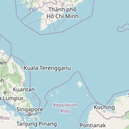
Distance from Kampot to Shantou
Distance between Kampot and Shantou is 1944 kilometers (1208 miles).
Distance Map Between Kampot and Shantou
Kampot, Cambodia ↔ Shantou, Guangzhou, China = 1208 miles = 1944 km.


Leaflet | © OpenStreetMap
How far is it between Kampot and Shantou
Kampot is located in Cambodia with (10.6104,104.1815) coordinates and Shantou is located in China with (23.3681,116.7148) coordinates. The calculated flying distance from Kampot to Shantou is equal to 1208 miles which is equal to 1944 km.
| City/Place | Latitude and Longitude | GPS Coordinates |
|---|---|---|
| Kampot | 10.6104, 104.1815 | 10° 36´ 37.4760'' N 104° 10´ 53.2200'' E |
| Shantou | 23.3681, 116.7148 | 23° 22´ 5.3040'' N 116° 42´ 53.2440'' E |
Kampot, Cambodia
Related Distances from Kampot
| Cities | Distance |
|---|---|
| Kampot to Kampong Chhnang | 207 km |
| Kampot to Koh Kong | 243 km |
| Kampot to Kratie | 383 km |
| Kampot to Lumphat | 660 km |
| Kampot to Pailin | 489 km |
| Kampot to Paoy Pet | 522 km |
| Kampot to Phnom Penh | 148 km |
| Kampot to Phumi Veal Sre | 86 km |
| Kampot to Prey Veng | 235 km |
| Kampot to Pursat | 303 km |
Shantou, Guangzhou, China
Related Distances to Shantou
| Cities | Distance |
|---|---|
| Jiangmen to Shantou | 473 km |
| Huanggang to Shantou | 52 km |
| Maba to Shantou | 617 km |
| Dongguan to Shantou | 383 km |
| Zhongshan to Shantou | 797 km |
| Foshan to Shantou | 463 km |
| Puning to Shantou | 72 km |
| Haimen to Shantou | 33 km |
| Anbu to Shantou | 12 km |
| Meizhou to Shantou | 158 km |