Distance from Kamthi to Tumsar
Distance between Kamthi and Tumsar is 59 kilometers (37 miles).
Driving distance from Kamthi to Tumsar is 84 kilometers (52 miles).
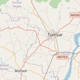
Distance Map Between Kamthi and Tumsar
Kamthi, Mumbai, India ↔ Tumsar, Mumbai, India = 37 miles = 59 km.


How far is it between Kāmthi and Tumsar
Kamthi is located in India with (21.2171,79.1945) coordinates and Tumsar is located in India with (21.3833,79.7333) coordinates. The calculated flying distance from Kamthi to Tumsar is equal to 37 miles which is equal to 59 km.
If you want to go by car, the driving distance between Kamthi and Tumsar is 84.19 km. If you ride your car with an average speed of 112 kilometers/hour (70 miles/h), travel time will be 00 hours 45 minutes. Please check the avg. speed travel time table on the right for various options.
Difference between fly and go by a car is 25 km.
| City/Place | Latitude and Longitude | GPS Coordinates |
|---|---|---|
| Kamthi | 21.2171, 79.1945 | 21° 13´ 1.7040'' N 79° 11´ 40.3080'' E |
| Tumsar | 21.3833, 79.7333 | 21° 22´ 59.9880'' N 79° 43´ 59.9880'' E |
Estimated Travel Time Between Kāmthi and Tumsar
| Average Speed | Travel Time |
|---|---|
| 30 mph (48 km/h) | 01 hours 45 minutes |
| 40 mph (64 km/h) | 01 hours 18 minutes |
| 50 mph (80 km/h) | 01 hours 03 minutes |
| 60 mph (97 km/h) | 00 hours 52 minutes |
| 70 mph (112 km/h) | 00 hours 45 minutes |
| 75 mph (120 km/h) | 00 hours 42 minutes |
Related Distances from Kamthi
| Cities | Distance |
|---|---|
| Kamthi to Nagpur | 16 km |
| Kamthi to Solapur | 662 km |
| Kamthi to Ramtek | 33 km |
| Kamthi to Pandharpur | 698 km |
| Kamthi to Pune | 726 km |
Related Distances to Tumsar
| Cities | Distance |
|---|---|
| Bhandara to Tumsar | 32 km |
| Nagpur to Tumsar | 93 km |
| Gondia to Tumsar | 66 km |
| Amravati to Tumsar | 260 km |
| Saoner to Tumsar | 103 km |