Distance from Kano to Alaghsas
Distance between Kano and Alaghsas is 561 kilometers (348 miles).
Driving distance from Kano to Alaghsas is 693 kilometers (431 miles).
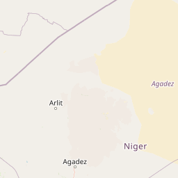
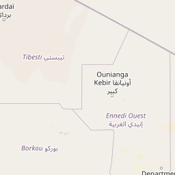
Distance Map Between Kano and Alaghsas
Kano, Nigeria ↔ Alaghsas, Agadez, Niger = 348 miles = 561 km.


How far is it between Kano and Alaghsas
Kano is located in Nigeria with (12.0001,8.5167) coordinates and Alaghsas is located in Niger with (17.0187,8.0168) coordinates. The calculated flying distance from Kano to Alaghsas is equal to 348 miles which is equal to 561 km.
If you want to go by car, the driving distance between Kano and Alaghsas is 693.49 km. If you ride your car with an average speed of 112 kilometers/hour (70 miles/h), travel time will be 06 hours 11 minutes. Please check the avg. speed travel time table on the right for various options.
Difference between fly and go by a car is 132 km.
| City/Place | Latitude and Longitude | GPS Coordinates |
|---|---|---|
| Kano | 12.0001, 8.5167 | 12° 0´ 0.4320'' N 8° 31´ 0.1920'' E |
| Alaghsas | 17.0187, 8.0168 | 17° 1´ 7.3200'' N 8° 1´ 0.4800'' E |
Estimated Travel Time Between Kano and Alaghsas
| Average Speed | Travel Time |
|---|---|
| 30 mph (48 km/h) | 14 hours 26 minutes |
| 40 mph (64 km/h) | 10 hours 50 minutes |
| 50 mph (80 km/h) | 08 hours 40 minutes |
| 60 mph (97 km/h) | 07 hours 08 minutes |
| 70 mph (112 km/h) | 06 hours 11 minutes |
| 75 mph (120 km/h) | 05 hours 46 minutes |
Related Distances from Kano
| Cities | Distance |
|---|---|
| Kano to Niamey | 920 km |
| Kano to Agadez | 716 km |
| Kano to Maradi | 260 km |
| Kano to Zinder | 271 km |
| Kano to Gaya 2 | 711 km |
Related Distances to Alaghsas
| Cities | Distance |
|---|---|
| Maiduguri to Alaghsas | 1102 km |
| Zaria to Alaghsas | 857 km |
| Kaduna to Alaghsas | 934 km |
| Ilorin to Alaghsas | 1424 km |
| Lagos to Alaghsas | 1684 km |