Distance from Kaolack to Accra
Distance between Kaolack and Accra is 2002 kilometers (1244 miles).
Driving distance from Kaolack to Accra is 2736 kilometers (1700 miles).
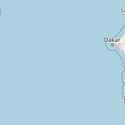
Distance Map Between Kaolack and Accra
Kaolack, Senegal ↔ Accra, Ghana = 1244 miles = 2002 km.


How far is it between Kaolack and Accra
Kaolack is located in Senegal with (14.1825,-16.2533) coordinates and Accra is located in Ghana with (5.556,-0.1969) coordinates. The calculated flying distance from Kaolack to Accra is equal to 1244 miles which is equal to 2002 km.
If you want to go by car, the driving distance between Kaolack and Accra is 2736.42 km. If you ride your car with an average speed of 112 kilometers/hour (70 miles/h), travel time will be 24 hours 25 minutes. Please check the avg. speed travel time table on the right for various options.
Difference between fly and go by a car is 734 km.
| City/Place | Latitude and Longitude | GPS Coordinates |
|---|---|---|
| Kaolack | 14.1825, -16.2533 | 14° 10´ 57.0000'' N 16° 15´ 11.9880'' W |
| Accra | 5.556, -0.1969 | 5° 33´ 21.6720'' N 0° 11´ 48.8400'' W |
Estimated Travel Time Between Kaolack and Accra
| Average Speed | Travel Time |
|---|---|
| 30 mph (48 km/h) | 57 hours 00 minutes |
| 40 mph (64 km/h) | 42 hours 45 minutes |
| 50 mph (80 km/h) | 34 hours 12 minutes |
| 60 mph (97 km/h) | 28 hours 12 minutes |
| 70 mph (112 km/h) | 24 hours 25 minutes |
| 75 mph (120 km/h) | 22 hours 48 minutes |
Related Distances from Kaolack
| Cities | Distance |
|---|---|
| Kaolack to Accra | 2736 km |
| Kaolack to Kumasi | 2485 km |
Related Distances to Accra
| Cities | Distance |
|---|---|
| Dakar to Accra | 2903 km |
| Grand Dakar to Accra | 2904 km |
| Kaolack to Accra | 2736 km |
| Tambacounda to Accra | 2444 km |
| Dara to Accra | 2705 km |