Distance from Karlstad to Umea
Distance between Karlstad and Umea is 610 kilometers (379 miles).
Driving distance from Karlstad to Umea is 811 kilometers (504 miles).
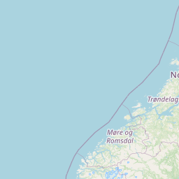
Distance Map Between Karlstad and Umea
Karlstad, Sweden ↔ Umea, Sweden = 379 miles = 610 km.


How far is it between Karlstad and Umeå
Karlstad is located in Sweden with (59.3793,13.5036) coordinates and Umea is located in Sweden with (63.8284,20.2597) coordinates. The calculated flying distance from Karlstad to Umea is equal to 379 miles which is equal to 610 km.
If you want to go by car, the driving distance between Karlstad and Umea is 810.85 km. If you ride your car with an average speed of 112 kilometers/hour (70 miles/h), travel time will be 07 hours 14 minutes. Please check the avg. speed travel time table on the right for various options.
Difference between fly and go by a car is 201 km.
| City/Place | Latitude and Longitude | GPS Coordinates |
|---|---|---|
| Karlstad | 59.3793, 13.5036 | 59° 22´ 45.4800'' N 13° 30´ 12.8520'' E |
| Umea | 63.8284, 20.2597 | 63° 49´ 42.3120'' N 20° 15´ 34.9920'' E |
Estimated Travel Time Between Karlstad and Umeå
| Average Speed | Travel Time |
|---|---|
| 30 mph (48 km/h) | 16 hours 53 minutes |
| 40 mph (64 km/h) | 12 hours 40 minutes |
| 50 mph (80 km/h) | 10 hours 08 minutes |
| 60 mph (97 km/h) | 08 hours 21 minutes |
| 70 mph (112 km/h) | 07 hours 14 minutes |
| 75 mph (120 km/h) | 06 hours 45 minutes |
Related Distances from Karlstad
| Cities | Distance |
|---|---|
| Karlstad to Stockholm | 309 km |
| Karlstad to Orebro | 110 km |
| Karlstad to Vasteras | 205 km |
| Karlstad to Kristinehamn | 42 km |
| Karlstad to Uppsala | 281 km |
Related Distances to Umea
| Cities | Distance |
|---|---|
| Stockholm to Umea | 636 km |
| Skelleftea to Umea | 135 km |
| Malmoe to Umea | 1245 km |
| Ostersund to Umea | 363 km |
| Uppsala to Umea | 571 km |