Distance from Kayunga to Njeru
Distance between Kayunga and Njeru is 45 kilometers (28 miles).
Driving distance from Kayunga to Njeru is 49 kilometers (31 miles).
Distance Map Between Kayunga and Njeru
Kayunga, Kampala, Uganda ↔ Njeru, Kampala, Uganda = 28 miles = 45 km.


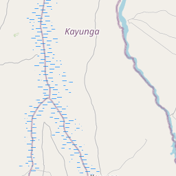


How far is it between Kayunga and Njeru
Kayunga is located in Uganda with (0.7025,32.8886) coordinates and Njeru is located in Uganda with (0.4186,33.1731) coordinates. The calculated flying distance from Kayunga to Njeru is equal to 28 miles which is equal to 45 km.
If you want to go by car, the driving distance between Kayunga and Njeru is 49.12 km. If you ride your car with an average speed of 112 kilometers/hour (70 miles/h), travel time will be 00 hours 26 minutes. Please check the avg. speed travel time table on the right for various options.
Difference between fly and go by a car is 4 km.
| City/Place | Latitude and Longitude | GPS Coordinates |
|---|---|---|
| Kayunga | 0.7025, 32.8886 | 0° 42´ 9.0000'' N 32° 53´ 18.9960'' E |
| Njeru | 0.4186, 33.1731 | 0° 25´ 6.9960'' N 33° 10´ 23.0160'' E |
Estimated Travel Time Between Kayunga and Njeru
| Average Speed | Travel Time |
|---|---|
| 30 mph (48 km/h) | 01 hours 01 minutes |
| 40 mph (64 km/h) | 00 hours 46 minutes |
| 50 mph (80 km/h) | 00 hours 36 minutes |
| 60 mph (97 km/h) | 00 hours 30 minutes |
| 70 mph (112 km/h) | 00 hours 26 minutes |
| 75 mph (120 km/h) | 00 hours 24 minutes |
Related Distances from Kayunga
| Cities | Distance |
|---|---|
| Kayunga to Mukono | 52 km |
| Kayunga to Luwero | 74 km |
| Kayunga to Wakiso | 78 km |
| Kayunga to Lugazi | 48 km |
| Kayunga to Mityana | 130 km |
Related Distances to Njeru
| Cities | Distance |
|---|---|
| Kayunga to Njeru | 49 km |
| Mukono to Njeru | 53 km |
| Masaka to Njeru | 210 km |
| Kireka to Njeru | 67 km |
| Luwero to Njeru | 117 km |