Distance from Keene to Laval
Distance between Keene and Laval is 314 kilometers (195 miles).
Driving distance from Keene to Laval is 409 kilometers (254 miles).
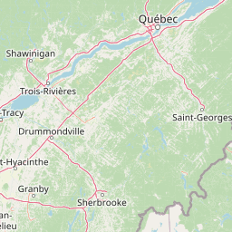
Distance Map Between Keene and Laval
Keene, Concord, United States ↔ Laval, Quebec, Canada = 195 miles = 314 km.


How far is it between Keene and Laval
Keene is located in United States with (42.9337,-72.2781) coordinates and Laval is located in Canada with (45.57,-73.692) coordinates. The calculated flying distance from Keene to Laval is equal to 195 miles which is equal to 314 km.
If you want to go by car, the driving distance between Keene and Laval is 408.76 km. If you ride your car with an average speed of 112 kilometers/hour (70 miles/h), travel time will be 03 hours 38 minutes. Please check the avg. speed travel time table on the right for various options.
Difference between fly and go by a car is 95 km.
| City/Place | Latitude and Longitude | GPS Coordinates |
|---|---|---|
| Keene | 42.9337, -72.2781 | 42° 56´ 1.2840'' N 72° 16´ 41.3040'' W |
| Laval | 45.57, -73.692 | 45° 34´ 11.8200'' N 73° 41´ 31.2000'' W |
Estimated Travel Time Between Keene and Laval
| Average Speed | Travel Time |
|---|---|
| 30 mph (48 km/h) | 08 hours 30 minutes |
| 40 mph (64 km/h) | 06 hours 23 minutes |
| 50 mph (80 km/h) | 05 hours 06 minutes |
| 60 mph (97 km/h) | 04 hours 12 minutes |
| 70 mph (112 km/h) | 03 hours 38 minutes |
| 75 mph (120 km/h) | 03 hours 24 minutes |
Related Distances from Keene
| Cities | Distance |
|---|---|
| Keene to Montreal | 393 km |
| Keene to Toronto | 778 km |
| Keene to Halifax | 1140 km |
| Keene to Richmond Hill | 794 km |
| Keene to Oshawa | 774 km |
Related Distances to Laval
| Cities | Distance |
|---|---|
| New York City to Laval | 619 km |
| Washington D C to Laval | 964 km |
| Boston to Laval | 515 km |
| Niagara Falls 2 to Laval | 663 km |
| New Brunswick to Laval | 655 km |