Distance from Kendall to Davie
Distance between Kendall and Davie is 43 kilometers (27 miles).
Driving distance from Kendall to Davie is 59 kilometers (36 miles).
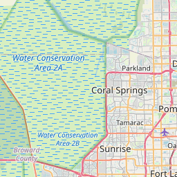
Distance Map Between Kendall and Davie
Kendall, Tallahassee, United States ↔ Davie, Tallahassee, United States = 27 miles = 43 km.


How far is it between Kendall and Davie
Kendall is located in United States with (25.6793,-80.3173) coordinates and Davie is located in United States with (26.0629,-80.2331) coordinates. The calculated flying distance from Kendall to Davie is equal to 27 miles which is equal to 43 km.
If you want to go by car, the driving distance between Kendall and Davie is 58.69 km. If you ride your car with an average speed of 112 kilometers/hour (70 miles/h), travel time will be 00 hours 31 minutes. Please check the avg. speed travel time table on the right for various options.
Difference between fly and go by a car is 16 km.
| City/Place | Latitude and Longitude | GPS Coordinates |
|---|---|---|
| Kendall | 25.6793, -80.3173 | 25° 40´ 45.3720'' N 80° 19´ 2.1720'' W |
| Davie | 26.0629, -80.2331 | 26° 3´ 46.3320'' N 80° 13´ 59.1600'' W |
Estimated Travel Time Between Kendall and Davie
| Average Speed | Travel Time |
|---|---|
| 30 mph (48 km/h) | 01 hours 13 minutes |
| 40 mph (64 km/h) | 00 hours 55 minutes |
| 50 mph (80 km/h) | 00 hours 44 minutes |
| 60 mph (97 km/h) | 00 hours 36 minutes |
| 70 mph (112 km/h) | 00 hours 31 minutes |
| 75 mph (120 km/h) | 00 hours 29 minutes |
Related Distances from Kendall
| Cities | Distance |
|---|---|
| Kendall to Homestead | 39 km |
| Kendall to Doral | 21 km |
| Kendall to Boca Raton | 95 km |
| Kendall to Coral Gables | 9 km |
| Kendall to Aventura | 50 km |
Related Distances to Davie
| Cities | Distance |
|---|---|
| Miami to Davie | 37 km |
| Deerfield Beach to Davie | 39 km |
| Miami Beach to Davie | 42 km |
| Sunrise to Davie | 22 km |
| Fort Lauderdale to Davie | 16 km |