Distance from Key West to Carol City
Distance between Key West and Carol City is 218 kilometers (136 miles).
Driving distance from Key West to Carol City is 274 kilometers (170 miles).
Distance Map Between Key West and Carol City
Key West, Tallahassee, United States ↔ Carol City, Tallahassee, United States = 136 miles = 218 km.


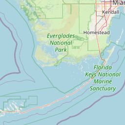
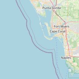


How far is it between Key West and Carol City
Key West is located in United States with (24.5557,-81.7826) coordinates and Carol City is located in United States with (25.9407,-80.2456) coordinates. The calculated flying distance from Key West to Carol City is equal to 136 miles which is equal to 218 km.
If you want to go by car, the driving distance between Key West and Carol City is 273.93 km. If you ride your car with an average speed of 112 kilometers/hour (70 miles/h), travel time will be 02 hours 26 minutes. Please check the avg. speed travel time table on the right for various options.
Difference between fly and go by a car is 56 km.
| City/Place | Latitude and Longitude | GPS Coordinates |
|---|---|---|
| Key West | 24.5557, -81.7826 | 24° 33´ 20.5200'' N 81° 46´ 57.3240'' W |
| Carol City | 25.9407, -80.2456 | 25° 56´ 26.3400'' N 80° 14´ 44.1600'' W |
Estimated Travel Time Between Key West and Carol City
| Average Speed | Travel Time |
|---|---|
| 30 mph (48 km/h) | 05 hours 42 minutes |
| 40 mph (64 km/h) | 04 hours 16 minutes |
| 50 mph (80 km/h) | 03 hours 25 minutes |
| 60 mph (97 km/h) | 02 hours 49 minutes |
| 70 mph (112 km/h) | 02 hours 26 minutes |
| 75 mph (120 km/h) | 02 hours 16 minutes |
Related Distances from Key West
| Cities | Distance |
|---|---|
| Key West to Fort Lauderdale | 305 km |
| Key West to Fort Myers | 483 km |
| Key West to Homestead | 205 km |
| Key West to Daytona Beach | 674 km |
| Key West to Cape Coral | 486 km |
Related Distances to Carol City
| Cities | Distance |
|---|---|
| Miami Gardens to Carol City | 0 km |
| Homestead to Carol City | 73 km |
| Miami to Carol City | 24 km |
| Hollywood 2 to Carol City | 17 km |
| Miami Beach to Carol City | 29 km |