Distance from Khammam to Kodar
Distance between Khammam and Kodar is 34 kilometers (21 miles).
Driving distance from Khammam to Kodar is 36 kilometers (23 miles).
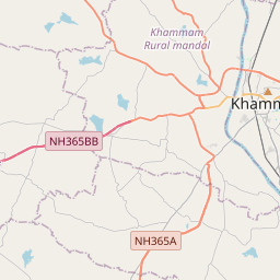
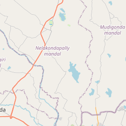
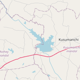
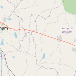
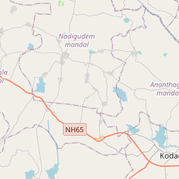
Distance Map Between Khammam and Kodar
Khammam, Hyderabad, India ↔ Kodar, Hyderabad, India = 21 miles = 34 km.


How far is it between Khammam and Kodār
Khammam is located in India with (17.2477,80.1437) coordinates and Kodar is located in India with (16.9985,79.9656) coordinates. The calculated flying distance from Khammam to Kodar is equal to 21 miles which is equal to 34 km.
If you want to go by car, the driving distance between Khammam and Kodar is 36.34 km. If you ride your car with an average speed of 112 kilometers/hour (70 miles/h), travel time will be 00 hours 19 minutes. Please check the avg. speed travel time table on the right for various options.
Difference between fly and go by a car is 2 km.
| City/Place | Latitude and Longitude | GPS Coordinates |
|---|---|---|
| Khammam | 17.2477, 80.1437 | 17° 14´ 51.6120'' N 80° 8´ 37.2480'' E |
| Kodar | 16.9985, 79.9656 | 16° 59´ 54.6000'' N 79° 57´ 56.1600'' E |
Estimated Travel Time Between Khammam and Kodār
| Average Speed | Travel Time |
|---|---|
| 30 mph (48 km/h) | 00 hours 45 minutes |
| 40 mph (64 km/h) | 00 hours 34 minutes |
| 50 mph (80 km/h) | 00 hours 27 minutes |
| 60 mph (97 km/h) | 00 hours 22 minutes |
| 70 mph (112 km/h) | 00 hours 19 minutes |
| 75 mph (120 km/h) | 00 hours 18 minutes |
Related Distances from Khammam
| Cities | Distance |
|---|---|
| Khammam to Yellandu | 47 km |
| Khammam to Paloncha | 89 km |
| Khammam to Mahbubabad | 51 km |
| Khammam to Siddipet | 202 km |
| Khammam to Warangal | 123 km |
Related Distances to Kodar
| Cities | Distance |
|---|---|
| Chatra to Kodarma | 101 km |
| Khunti to Kodarma | 195 km |
| Giridih to Kodarma | 97 km |
| Dumka to Kodarma | 213 km |
| Hazaribag to Kodarma | 68 km |