Distance from Kizel to Kostanay
Distance between Kizel and Kostanay is 746 kilometers (464 miles).
Driving distance from Kizel to Kostanay is 973 kilometers (605 miles).
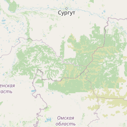
Distance Map Between Kizel and Kostanay
Kizel, Perm, Russia ↔ Kostanay, Kazakhstan = 464 miles = 746 km.


How far is it between Kizel and Kostanay
Kizel is located in Russia with (59.0471,57.6477) coordinates and Kostanay is located in Kazakhstan with (53.2144,63.6246) coordinates. The calculated flying distance from Kizel to Kostanay is equal to 464 miles which is equal to 746 km.
If you want to go by car, the driving distance between Kizel and Kostanay is 972.99 km. If you ride your car with an average speed of 112 kilometers/hour (70 miles/h), travel time will be 08 hours 41 minutes. Please check the avg. speed travel time table on the right for various options.
Difference between fly and go by a car is 227 km.
| City/Place | Latitude and Longitude | GPS Coordinates |
|---|---|---|
| Kizel | 59.0471, 57.6477 | 59° 2´ 49.5240'' N 57° 38´ 51.6120'' E |
| Kostanay | 53.2144, 63.6246 | 53° 12´ 51.6600'' N 63° 37´ 28.6680'' E |
Estimated Travel Time Between Kizel and Kostanay
| Average Speed | Travel Time |
|---|---|
| 30 mph (48 km/h) | 20 hours 16 minutes |
| 40 mph (64 km/h) | 15 hours 12 minutes |
| 50 mph (80 km/h) | 12 hours 09 minutes |
| 60 mph (97 km/h) | 10 hours 01 minutes |
| 70 mph (112 km/h) | 08 hours 41 minutes |
| 75 mph (120 km/h) | 08 hours 06 minutes |
Related Distances from Kizel
| Cities | Distance |
|---|---|
| Kizel to Atyrau | 1709 km |
| Kizel to Oral | 1224 km |
| Kizel to Kyzylorda | 2195 km |
| Kizel to Astana | 1546 km |
| Kizel to Kostanay | 973 km |
Related Distances to Kostanay
| Cities | Distance |
|---|---|
| Yekaterinburg to Kostanay | 547 km |
| Chelyabinsk to Kostanay | 318 km |
| Salekhard to Kostanay | 2708 km |
| Novosibirsk to Kostanay | 1375 km |
| Perm to Kostanay | 902 km |