Distance from Kohror Pakka to Kabul
Distance between Kohror Pakka and Kabul is 603 kilometers (375 miles).
Driving distance from Kohror Pakka to Kabul is 785 kilometers (488 miles).
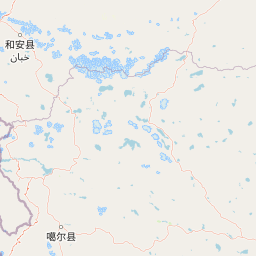
Distance Map Between Kohror Pakka and Kabul
Kohror Pakka, Lahore, Pakistan ↔ Kabul, Afghanistan = 375 miles = 603 km.


How far is it between Kohror Pakka and Kabul
Kohror Pakka is located in Pakistan with (29.6238,71.9167) coordinates and Kabul is located in Afghanistan with (34.5281,69.1723) coordinates. The calculated flying distance from Kohror Pakka to Kabul is equal to 375 miles which is equal to 603 km.
If you want to go by car, the driving distance between Kohror Pakka and Kabul is 784.74 km. If you ride your car with an average speed of 112 kilometers/hour (70 miles/h), travel time will be 07 hours 00 minutes. Please check the avg. speed travel time table on the right for various options.
Difference between fly and go by a car is 182 km.
| City/Place | Latitude and Longitude | GPS Coordinates |
|---|---|---|
| Kohror Pakka | 29.6238, 71.9167 | 29° 37´ 25.7520'' N 71° 55´ 0.2280'' E |
| Kabul | 34.5281, 69.1723 | 34° 31´ 41.2680'' N 69° 10´ 20.3880'' E |
Estimated Travel Time Between Kohror Pakka and Kabul
| Average Speed | Travel Time |
|---|---|
| 30 mph (48 km/h) | 16 hours 20 minutes |
| 40 mph (64 km/h) | 12 hours 15 minutes |
| 50 mph (80 km/h) | 09 hours 48 minutes |
| 60 mph (97 km/h) | 08 hours 05 minutes |
| 70 mph (112 km/h) | 07 hours 00 minutes |
| 75 mph (120 km/h) | 06 hours 32 minutes |
Related Distances from Kohror Pakka
| Cities | Distance |
|---|---|
| Kohror Pakka to Kabul | 785 km |
Related Distances to Kabul
| Cities | Distance |
|---|---|
| Lala Musa to Kabul | 610 km |
| Sibi to Kabul | 873 km |
| Malakwal City to Kabul | 635 km |
| Karachi to Kabul | 1404 km |
| Gwadar to Kabul | 1807 km |
| Mingora to Kabul | 457 km |
| Quetta to Kabul | 709 km |
| Gujar Khan to Kabul | 521 km |
| Islamabad to Kabul | 476 km |
| Lahore to Kabul | 801 km |