Distance from Kostroma to Kursk
Distance between Kostroma and Kursk is 736 kilometers (457 miles).
Driving distance from Kostroma to Kursk is 871 kilometers (541 miles).
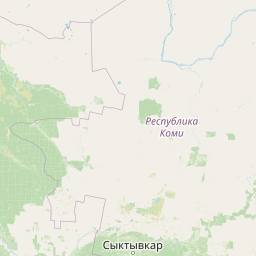
Distance Map Between Kostroma and Kursk
Kostroma, Russia ↔ Kursk, Russia = 457 miles = 736 km.


How far is it between Kostroma and Kursk
Kostroma is located in Russia with (57.7665,40.9269) coordinates and Kursk is located in Russia with (51.7373,36.1874) coordinates. The calculated flying distance from Kostroma to Kursk is equal to 457 miles which is equal to 736 km.
If you want to go by car, the driving distance between Kostroma and Kursk is 870.98 km. If you ride your car with an average speed of 112 kilometers/hour (70 miles/h), travel time will be 07 hours 46 minutes. Please check the avg. speed travel time table on the right for various options.
Difference between fly and go by a car is 135 km.
| City/Place | Latitude and Longitude | GPS Coordinates |
|---|---|---|
| Kostroma | 57.7665, 40.9269 | 57° 45´ 59.2920'' N 40° 55´ 36.6960'' E |
| Kursk | 51.7373, 36.1874 | 51° 44´ 14.3880'' N 36° 11´ 14.4600'' E |
Estimated Travel Time Between Kostroma and Kursk
| Average Speed | Travel Time |
|---|---|
| 30 mph (48 km/h) | 18 hours 08 minutes |
| 40 mph (64 km/h) | 13 hours 36 minutes |
| 50 mph (80 km/h) | 10 hours 53 minutes |
| 60 mph (97 km/h) | 08 hours 58 minutes |
| 70 mph (112 km/h) | 07 hours 46 minutes |
| 75 mph (120 km/h) | 07 hours 15 minutes |
Related Distances from Kostroma
| Cities | Distance |
|---|---|
| Kostroma to Moscow | 340 km |
| Kostroma to Vologda | 279 km |
| Kostroma to Yaroslavl | 84 km |
| Kostroma to Saint Petersburg | 854 km |
| Kostroma to Vladimir | 222 km |
Related Distances to Kursk
| Cities | Distance |
|---|---|
| Belgorod to Kursk | 142 km |
| Kazan to Kursk | 1261 km |
| Vladivostok to Kursk | 9336 km |
| Bryansk to Kursk | 249 km |
| Krasnodar to Kursk | 1059 km |