Distance from Kozeyevo to Zhulebino
Distance between Kozeyevo and Zhulebino is 24 kilometers (15 miles).
Driving distance from Kozeyevo to Zhulebino is 34 kilometers (21 miles).
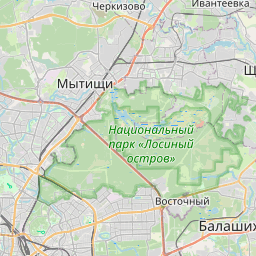
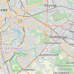
Distance Map Between Kozeyevo and Zhulebino
Kozeyevo, Moscow, Russia ↔ Zhulebino, Moscow, Russia = 15 miles = 24 km.


How far is it between Kozeyevo and Zhulebino
Kozeyevo is located in Russia with (55.8667,37.6167) coordinates and Zhulebino is located in Russia with (55.7,37.85) coordinates. The calculated flying distance from Kozeyevo to Zhulebino is equal to 15 miles which is equal to 24 km.
If you want to go by car, the driving distance between Kozeyevo and Zhulebino is 34.48 km. If you ride your car with an average speed of 112 kilometers/hour (70 miles/h), travel time will be 00 hours 18 minutes. Please check the avg. speed travel time table on the right for various options.
Difference between fly and go by a car is 10 km.
| City/Place | Latitude and Longitude | GPS Coordinates |
|---|---|---|
| Kozeyevo | 55.8667, 37.6167 | 55° 52´ 0.0120'' N 37° 37´ 0.0120'' E |
| Zhulebino | 55.7, 37.85 | 55° 42´ 0.0000'' N 37° 51´ 0.0000'' E |
Estimated Travel Time Between Kozeyevo and Zhulebino
| Average Speed | Travel Time |
|---|---|
| 30 mph (48 km/h) | 00 hours 43 minutes |
| 40 mph (64 km/h) | 00 hours 32 minutes |
| 50 mph (80 km/h) | 00 hours 25 minutes |
| 60 mph (97 km/h) | 00 hours 21 minutes |
| 70 mph (112 km/h) | 00 hours 18 minutes |
| 75 mph (120 km/h) | 00 hours 17 minutes |
Related Distances from Kozeyevo
| Cities | Distance |
|---|---|
| Kozeyevo to Troparevo | 33 km |
| Kozeyevo to Ryazanskiy | 25 km |
| Kozeyevo to Setun | 29 km |
| Kozeyevo to Annino 2 | 58 km |
| Kozeyevo to Sokol Niki | 10 km |
Related Distances to Zhulebino
| Cities | Distance |
|---|---|
| Sviblovo to Zhulebino | 33 km |
| Tsaritsyno to Zhulebino | 27 km |
| Gol Yanovo to Zhulebino | 17 km |
| Khimki to Zhulebino | 52 km |
| Nikulino to Zhulebino | 43 km |