Distance from La Porte to Garland
Distance between La Porte and Garland is 392 kilometers (244 miles).
Driving distance from La Porte to Garland is 446 kilometers (277 miles).
Distance Map Between La Porte and Garland
La Porte, Austin, United States ↔ Garland, Austin, United States = 244 miles = 392 km.


How far is it between La Porte and Garland
La Porte is located in United States with (29.6658,-95.0194) coordinates and Garland is located in United States with (32.9126,-96.6389) coordinates. The calculated flying distance from La Porte to Garland is equal to 244 miles which is equal to 392 km.
If you want to go by car, the driving distance between La Porte and Garland is 445.74 km. If you ride your car with an average speed of 112 kilometers/hour (70 miles/h), travel time will be 03 hours 58 minutes. Please check the avg. speed travel time table on the right for various options.
Difference between fly and go by a car is 54 km.
| City/Place | Latitude and Longitude | GPS Coordinates |
|---|---|---|
| La Porte | 29.6658, -95.0194 | 29° 39´ 56.8080'' N 95° 1´ 9.7320'' W |
| Garland | 32.9126, -96.6389 | 32° 54´ 45.4320'' N 96° 38´ 19.9680'' W |
Estimated Travel Time Between La Porte and Garland
| Average Speed | Travel Time |
|---|---|
| 30 mph (48 km/h) | 09 hours 17 minutes |
| 40 mph (64 km/h) | 06 hours 57 minutes |
| 50 mph (80 km/h) | 05 hours 34 minutes |
| 60 mph (97 km/h) | 04 hours 35 minutes |
| 70 mph (112 km/h) | 03 hours 58 minutes |
| 75 mph (120 km/h) | 03 hours 42 minutes |
Related Distances from La Porte
| Cities | Distance |
|---|---|
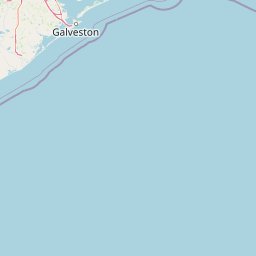
| La Porte to Galveston | 56 km |
| La Porte to Houston | 42 km |
| La Porte to Dallas | 426 km |
| La Porte to Baytown | 12 km |
| La Porte to College Station | 195 km |
Related Distances to Garland
| Cities | Distance |
|---|---|
| Irving to Garland | 40 km |
| Mesquite to Garland | 21 km |
| Plano to Garland | 17 km |
| Mckinney to Garland | 41 km |
| Houston to Garland | 405 km |