Distance from Lagos to Agadir
Distance between Lagos and Agadir is 748 kilometers (465 miles).
Driving distance from Lagos to Agadir is 1305 kilometers (811 miles).
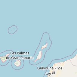
Distance Map Between Lagos and Agadir
Lagos, Faro, Portugal ↔ Agadir, Morocco = 465 miles = 748 km.


How far is it between Lagos and Agadir
Lagos is located in Portugal with (37.102,-8.6742) coordinates and Agadir is located in Morocco with (30.4202,-9.5982) coordinates. The calculated flying distance from Lagos to Agadir is equal to 465 miles which is equal to 748 km.
If you want to go by car, the driving distance between Lagos and Agadir is 1305.27 km. If you ride your car with an average speed of 112 kilometers/hour (70 miles/h), travel time will be 11 hours 39 minutes. Please check the avg. speed travel time table on the right for various options.
Difference between fly and go by a car is 557 km.
| City/Place | Latitude and Longitude | GPS Coordinates |
|---|---|---|
| Lagos | 37.102, -8.6742 | 37° 6´ 7.2720'' N 8° 40´ 27.1920'' W |
| Agadir | 30.4202, -9.5982 | 30° 25´ 12.6480'' N 9° 35´ 53.3400'' W |
Estimated Travel Time Between Lagos and Agadir
| Average Speed | Travel Time |
|---|---|
| 30 mph (48 km/h) | 27 hours 11 minutes |
| 40 mph (64 km/h) | 20 hours 23 minutes |
| 50 mph (80 km/h) | 16 hours 18 minutes |
| 60 mph (97 km/h) | 13 hours 27 minutes |
| 70 mph (112 km/h) | 11 hours 39 minutes |
| 75 mph (120 km/h) | 10 hours 52 minutes |
Related Distances from Lagos
| Cities | Distance |
|---|---|
| Lagos 2 to Casablanca | 843 km |
| Lagos 2 to Rabat | 760 km |
| Lagos 2 to Marrakesh | 1076 km |
| Lagos 2 to Fes | 781 km |
| Lagos 2 to Agadir | 1305 km |
Related Distances to Agadir
| Cities | Distance |
|---|---|
| Lisbon to Agadir | 1477 km |
| Faro to Agadir | 1234 km |
| Albufeira to Agadir | 1260 km |
| Portimao to Agadir | 1283 km |
| Lagos 2 to Agadir | 1305 km |