Distance from Lamu to Mandera
Distance between Lamu and Mandera is 698 kilometers (434 miles).
Distance Map Between Lamu and Mandera
Lamu, Kenya ↔ Mandera, Kenya = 434 miles = 698 km.
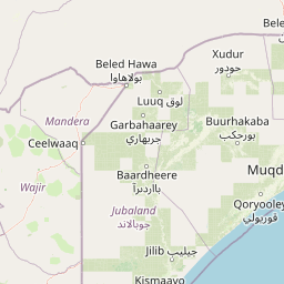
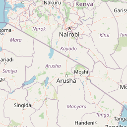


Leaflet | © OpenStreetMap
How far is it between Lamu and Mandera
Lamu is located in Kenya with (-2.2717,40.902) coordinates and Mandera is located in Kenya with (3.9373,41.8569) coordinates. The calculated flying distance from Lamu to Mandera is equal to 434 miles which is equal to 698 km.
| City/Place | Latitude and Longitude | GPS Coordinates |
|---|---|---|
| Lamu | -2.2717, 40.902 | 2° 16´ 18.0840'' S 40° 54´ 7.2360'' E |
| Mandera | 3.9373, 41.8569 | 3° 56´ 14.1360'' N 41° 51´ 24.7680'' E |
Mandera, Kenya
Related Distances to Mandera
| Cities | Distance |
|---|---|
| Garissa to Mandera | 713 km |
| Wajir to Mandera | 392 km |
| Moyale to Mandera | 380 km |
| Isiolo to Mandera | 740 km |
| Eldoret to Mandera | 1122 km |