Distance from Lansing to London
Distance between Lansing and London is 542 kilometers (337 miles).
Driving distance from Lansing to London is 632 kilometers (392 miles).
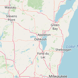
Distance Map Between Lansing and London
Lansing, Springfield, United States ↔ London, Ontario, Canada = 337 miles = 542 km.


How far is it between Lansing and London
Lansing is located in United States with (41.5648,-87.5389) coordinates and London is located in Canada with (42.9834,-81.233) coordinates. The calculated flying distance from Lansing to London is equal to 337 miles which is equal to 542 km.
If you want to go by car, the driving distance between Lansing and London is 631.5 km. If you ride your car with an average speed of 112 kilometers/hour (70 miles/h), travel time will be 05 hours 38 minutes. Please check the avg. speed travel time table on the right for various options.
Difference between fly and go by a car is 90 km.
| City/Place | Latitude and Longitude | GPS Coordinates |
|---|---|---|
| Lansing | 41.5648, -87.5389 | 41° 33´ 53.1360'' N 87° 32´ 20.1480'' W |
| London | 42.9834, -81.233 | 42° 59´ 0.2040'' N 81° 13´ 58.9440'' W |
Estimated Travel Time Between Lansing and London
| Average Speed | Travel Time |
|---|---|
| 30 mph (48 km/h) | 13 hours 09 minutes |
| 40 mph (64 km/h) | 09 hours 52 minutes |
| 50 mph (80 km/h) | 07 hours 53 minutes |
| 60 mph (97 km/h) | 06 hours 30 minutes |
| 70 mph (112 km/h) | 05 hours 38 minutes |
| 75 mph (120 km/h) | 05 hours 15 minutes |
Related Distances from Lansing
| Cities | Distance |
|---|---|
| Lansing 2 to Toronto | 804 km |
| Lansing 2 to Montreal | 1335 km |
| Lansing 2 to Hamilton | 744 km |
| Lansing 2 to Brampton | 780 km |
| Lansing 2 to Quebec | 1597 km |
Related Distances to London
| Cities | Distance |
|---|---|
| New York City to London 2 | 861 km |
| Kent 2 to London 2 | 501 km |
| Boston to London 2 | 954 km |
| Suffolk to London 2 | 1137 km |
| Jamaica to London 2 | 890 km |