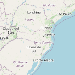
Distance from Lapa to Rolandia
Distance between Lapa and Rolandia is 321 kilometers (199 miles).
Driving distance from Lapa to Rolandia is 394 kilometers (245 miles).
Distance Map Between Lapa and Rolandia
Lapa, Curitiba, Brazil ↔ Rolandia, Curitiba, Brazil = 199 miles = 321 km.


How far is it between Lapa and Rolândia
Lapa is located in Brazil with (-25.7697,-49.7158) coordinates and Rolandia is located in Brazil with (-23.3097,-51.3692) coordinates. The calculated flying distance from Lapa to Rolandia is equal to 199 miles which is equal to 321 km.
If you want to go by car, the driving distance between Lapa and Rolandia is 393.59 km. If you ride your car with an average speed of 112 kilometers/hour (70 miles/h), travel time will be 03 hours 30 minutes. Please check the avg. speed travel time table on the right for various options.
Difference between fly and go by a car is 73 km.
| City/Place | Latitude and Longitude | GPS Coordinates |
|---|---|---|
| Lapa | -25.7697, -49.7158 | 25° 46´ 10.9920'' S 49° 42´ 56.9880'' W |
| Rolandia | -23.3097, -51.3692 | 23° 18´ 34.9920'' S 51° 22´ 9.0120'' W |
Estimated Travel Time Between Lapa and Rolândia
| Average Speed | Travel Time |
|---|---|
| 30 mph (48 km/h) | 08 hours 11 minutes |
| 40 mph (64 km/h) | 06 hours 08 minutes |
| 50 mph (80 km/h) | 04 hours 55 minutes |
| 60 mph (97 km/h) | 04 hours 03 minutes |
| 70 mph (112 km/h) | 03 hours 30 minutes |
| 75 mph (120 km/h) | 03 hours 16 minutes |
Related Distances from Lapa
| Cities | Distance |
|---|---|
| Lapa to Santo Antonio Da Platina | 353 km |
| Lapa to Sao Miguel Do Iguacu | 570 km |
| Lapa to Ponta Grossa | 103 km |
| Lapa to Pinhao | 287 km |
| Lapa to Sao Jose Dos Pinhais | 70 km |
Related Distances to Rolandia
| Cities | Distance |
|---|---|
| Jacarezinho to Rolandia | 180 km |
| Bandeirantes to Rolandia | 122 km |
| Palmeira to Rolandia | 340 km |
| Cruzeiro Do Oeste to Rolandia | 210 km |
| Pinhais to Rolandia | 414 km |