Distance from Lar to Tanda
Distance between Lar and Tanda is 136 kilometers (85 miles).
Driving distance from Lar to Tanda is 164 kilometers (102 miles).
Distance Map Between Lar and Tanda
Lar, Lucknow, India ↔ Tanda, Lucknow, India = 85 miles = 136 km.

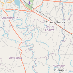


Leaflet | © OpenStreetMap
How far is it between Lār and Tāndā
Lar is located in India with (26.2026,83.9679) coordinates and Tanda is located in India with (26.5506,82.658) coordinates. The calculated flying distance from Lar to Tanda is equal to 85 miles which is equal to 136 km.
If you want to go by car, the driving distance between Lar and Tanda is 163.84 km. If you ride your car with an average speed of 112 kilometers/hour (70 miles/h), travel time will be 01 hours 27 minutes. Please check the avg. speed travel time table on the right for various options.
Difference between fly and go by a car is 28 km.
| City/Place | Latitude and Longitude | GPS Coordinates |
|---|---|---|
| Lar | 26.2026, 83.9679 | 26° 12´ 9.2880'' N 83° 58´ 4.5120'' E |
| Tanda | 26.5506, 82.658 | 26° 33´ 2.2680'' N 82° 39´ 28.8720'' E |
Estimated Travel Time Between Lār and Tāndā
| Average Speed | Travel Time |
|---|---|
| 30 mph (48 km/h) | 03 hours 24 minutes |
| 40 mph (64 km/h) | 02 hours 33 minutes |
| 50 mph (80 km/h) | 02 hours 02 minutes |
| 60 mph (97 km/h) | 01 hours 41 minutes |
| 70 mph (112 km/h) | 01 hours 27 minutes |
| 75 mph (120 km/h) | 01 hours 21 minutes |
Lar, Lucknow, India
Related Distances from Lar
| Cities | Distance |
|---|---|
| Lar to Mau | 87 km |
| Lar to Mubarakpur | 88 km |
| Lar to Sultanpur | 231 km |
| Lar to Varanasi | 180 km |
| Lar to Tanda 2 | 164 km |
Tanda, Lucknow, India
Related Distances to Tanda
| Cities | Distance |
|---|---|
| Akbarpur to Tanda 2 | 19 km |
| Basti to Tanda 2 | 38 km |
| Sultanpur to Tanda 2 | 74 km |
| Ayodhya to Tanda 2 | 59 km |
| Gorakhpur 2 to Tanda 2 | 108 km |