Distance from Laredo to Ecatepec
Distance between Laredo and Ecatepec is 878 kilometers (546 miles).
Driving distance from Laredo to Ecatepec is 1103 kilometers (686 miles).
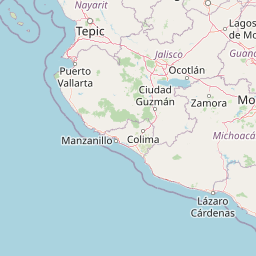
Distance Map Between Laredo and Ecatepec
Laredo, Austin, United States ↔ Ecatepec, Toluca, Mexico = 546 miles = 878 km.


How far is it between Laredo and Ecatepec
Laredo is located in United States with (27.5064,-99.5075) coordinates and Ecatepec is located in Mexico with (19.6173,-99.066) coordinates. The calculated flying distance from Laredo to Ecatepec is equal to 546 miles which is equal to 878 km.
If you want to go by car, the driving distance between Laredo and Ecatepec is 1103.49 km. If you ride your car with an average speed of 112 kilometers/hour (70 miles/h), travel time will be 09 hours 51 minutes. Please check the avg. speed travel time table on the right for various options.
Difference between fly and go by a car is 225 km.
| City/Place | Latitude and Longitude | GPS Coordinates |
|---|---|---|
| Laredo | 27.5064, -99.5075 | 27° 30´ 23.0760'' N 99° 30´ 27.1440'' W |
| Ecatepec | 19.6173, -99.066 | 19° 37´ 2.1000'' N 99° 3´ 57.6360'' W |
Estimated Travel Time Between Laredo and Ecatepec
| Average Speed | Travel Time |
|---|---|
| 30 mph (48 km/h) | 22 hours 59 minutes |
| 40 mph (64 km/h) | 17 hours 14 minutes |
| 50 mph (80 km/h) | 13 hours 47 minutes |
| 60 mph (97 km/h) | 11 hours 22 minutes |
| 70 mph (112 km/h) | 09 hours 51 minutes |
| 75 mph (120 km/h) | 09 hours 11 minutes |
Related Distances from Laredo
| Cities | Distance |
|---|---|
| Laredo to Alvaro Obregon | 1124 km |
| Laredo to Atoyac De Alvarez | 1581 km |
| Laredo to Chihuahua | 990 km |
| Laredo to Ciudad Juarez | 979 km |
| Laredo to Ciudad Nezahualcoyotl | 1127 km |
| Laredo to Ecatepec | 1103 km |
| Laredo to Guadalajara | 1011 km |
| Laredo to Guadalupe | 235 km |
| Laredo to Gustavo A Madero 2 | 632 km |
| Laredo to Iztapalapa | 1133 km |
Related Distances to Ecatepec
| Cities | Distance |
|---|---|
| Phenix City to Ecatepec | 2730 km |
| El Paso to Ecatepec | 1815 km |
| Mesa to Ecatepec | 2317 km |
| Austin to Ecatepec | 1485 km |
| Canyon Lake to Ecatepec | 1426 km |
| Bossier City to Ecatepec | 1970 km |
| Hollywood to Ecatepec | 2922 km |
| Paris 2 to Ecatepec | 1965 km |
| The Villages to Ecatepec | 3056 km |
| Palm Coast to Ecatepec | 3081 km |