Distance from Laredo to Leon
Distance between Laredo and Leon is 742 kilometers (461 miles).
Driving distance from Laredo to Leon is 908 kilometers (564 miles).
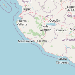
Distance Map Between Laredo and Leon
Laredo, Austin, United States ↔ Leon, Guanajuato, Mexico = 461 miles = 742 km.


How far is it between Laredo and León
Laredo is located in United States with (27.5064,-99.5075) coordinates and Leon is located in Mexico with (21.1305,-101.671) coordinates. The calculated flying distance from Laredo to Leon is equal to 461 miles which is equal to 742 km.
If you want to go by car, the driving distance between Laredo and Leon is 908.34 km. If you ride your car with an average speed of 112 kilometers/hour (70 miles/h), travel time will be 08 hours 06 minutes. Please check the avg. speed travel time table on the right for various options.
Difference between fly and go by a car is 166 km.
| City/Place | Latitude and Longitude | GPS Coordinates |
|---|---|---|
| Laredo | 27.5064, -99.5075 | 27° 30´ 23.0760'' N 99° 30´ 27.1440'' W |
| Leon | 21.1305, -101.671 | 21° 7´ 49.8720'' N 101° 40´ 15.6000'' W |
Estimated Travel Time Between Laredo and León
| Average Speed | Travel Time |
|---|---|
| 30 mph (48 km/h) | 18 hours 55 minutes |
| 40 mph (64 km/h) | 14 hours 11 minutes |
| 50 mph (80 km/h) | 11 hours 21 minutes |
| 60 mph (97 km/h) | 09 hours 21 minutes |
| 70 mph (112 km/h) | 08 hours 06 minutes |
| 75 mph (120 km/h) | 07 hours 34 minutes |
Related Distances from Laredo
| Cities | Distance |
|---|---|
| Laredo to Mexico City | 1123 km |
| Laredo to Monterrey | 227 km |
| Laredo to Chihuahua | 990 km |
| Laredo to Guadalajara | 1011 km |
| Laredo to Leon | 908 km |
Related Distances to Leon
| Cities | Distance |
|---|---|
| Houston to Leon | 1474 km |
| Los Angeles to Leon | 2754 km |
| Laredo to Leon | 908 km |
| Paris 2 to Leon | 1793 km |
| San Diego to Leon | 2444 km |