Distance from Laredo to Merida
Distance between Laredo and Merida is 1237 kilometers (769 miles).
Driving distance from Laredo to Merida is 2419 kilometers (1503 miles).
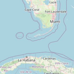
Distance Map Between Laredo and Merida
Laredo, Austin, United States ↔ Merida, Mexico = 769 miles = 1237 km.


How far is it between Laredo and Mérida
Laredo is located in United States with (27.5064,-99.5075) coordinates and Merida is located in Mexico with (20.9754,-89.617) coordinates. The calculated flying distance from Laredo to Merida is equal to 769 miles which is equal to 1237 km.
If you want to go by car, the driving distance between Laredo and Merida is 2418.79 km. If you ride your car with an average speed of 112 kilometers/hour (70 miles/h), travel time will be 21 hours 35 minutes. Please check the avg. speed travel time table on the right for various options.
Difference between fly and go by a car is 1182 km.
| City/Place | Latitude and Longitude | GPS Coordinates |
|---|---|---|
| Laredo | 27.5064, -99.5075 | 27° 30´ 23.0760'' N 99° 30´ 27.1440'' W |
| Merida | 20.9754, -89.617 | 20° 58´ 31.3320'' N 89° 37´ 1.0560'' W |
Estimated Travel Time Between Laredo and Mérida
| Average Speed | Travel Time |
|---|---|
| 30 mph (48 km/h) | 50 hours 23 minutes |
| 40 mph (64 km/h) | 37 hours 47 minutes |
| 50 mph (80 km/h) | 30 hours 14 minutes |
| 60 mph (97 km/h) | 24 hours 56 minutes |
| 70 mph (112 km/h) | 21 hours 35 minutes |
| 75 mph (120 km/h) | 20 hours 09 minutes |
Related Distances from Laredo
| Cities | Distance |
|---|---|
| Laredo to Mexico City | 1123 km |
| Laredo to Monterrey | 227 km |
| Laredo to Chihuahua | 990 km |
| Laredo to Guadalajara | 1011 km |
| Laredo to Leon | 908 km |
Related Distances to Merida
| Cities | Distance |
|---|---|
| Houston to Merida | 2590 km |
| Galveston to Merida | 2631 km |
| San Antonio to Merida | 2397 km |
| Miami to Merida | 4470 km |
| Corpus Christi to Merida | 2238 km |