Distance from Lathi to Veraval
Distance between Lathi and Veraval is 139 kilometers (87 miles).
Driving distance from Lathi to Veraval is 186 kilometers (116 miles).
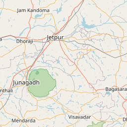
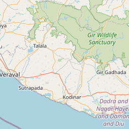
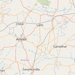
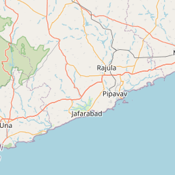
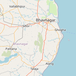
Distance Map Between Lathi and Veraval
Lathi, Ghandinagar, India ↔ Veraval, Ghandinagar, India = 87 miles = 139 km.


How far is it between Lāthi and Verāval
Lathi is located in India with (21.7231,71.3884) coordinates and Veraval is located in India with (20.9077,70.3679) coordinates. The calculated flying distance from Lathi to Veraval is equal to 87 miles which is equal to 139 km.
If you want to go by car, the driving distance between Lathi and Veraval is 186.27 km. If you ride your car with an average speed of 112 kilometers/hour (70 miles/h), travel time will be 01 hours 39 minutes. Please check the avg. speed travel time table on the right for various options.
Difference between fly and go by a car is 47 km.
| City/Place | Latitude and Longitude | GPS Coordinates |
|---|---|---|
| Lathi | 21.7231, 71.3884 | 21° 43´ 23.1600'' N 71° 23´ 18.3480'' E |
| Veraval | 20.9077, 70.3679 | 20° 54´ 27.7200'' N 70° 22´ 4.2960'' E |
Estimated Travel Time Between Lāthi and Verāval
| Average Speed | Travel Time |
|---|---|
| 30 mph (48 km/h) | 03 hours 52 minutes |
| 40 mph (64 km/h) | 02 hours 54 minutes |
| 50 mph (80 km/h) | 02 hours 19 minutes |
| 60 mph (97 km/h) | 01 hours 55 minutes |
| 70 mph (112 km/h) | 01 hours 39 minutes |
| 75 mph (120 km/h) | 01 hours 33 minutes |
Related Distances from Lathi
| Cities | Distance |
|---|---|
| Lathi to Rajkot | 100 km |
| Lathi to Una | 135 km |
| Lathi to Palitana | 61 km |
| Lathi to Surat | 410 km |
| Lathi to Rajula | 89 km |
Related Distances to Veraval
| Cities | Distance |
|---|---|
| Mangrol to Veraval | 44 km |
| Kodinar to Veraval | 47 km |
| Junagadh to Veraval | 87 km |
| Ahmedabad to Veraval | 406 km |
| Rajkot to Veraval | 189 km |