Distance from Les Cayes to Miragoane
Distance between Les Cayes and Miragoane is 75 kilometers (46 miles).
Driving distance from Les Cayes to Miragoane is 103 kilometers (64 miles).
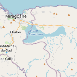
Distance Map Between Les Cayes and Miragoane
Les Cayes, Haiti ↔ Miragoane, Haiti = 46 miles = 75 km.


How far is it between Les Cayes and Miragoâne
Les Cayes is located in Haiti with (18.1933,-73.746) coordinates and Miragoane is located in Haiti with (18.4423,-73.0876) coordinates. The calculated flying distance from Les Cayes to Miragoane is equal to 46 miles which is equal to 75 km.
If you want to go by car, the driving distance between Les Cayes and Miragoane is 102.64 km. If you ride your car with an average speed of 112 kilometers/hour (70 miles/h), travel time will be 00 hours 54 minutes. Please check the avg. speed travel time table on the right for various options.
Difference between fly and go by a car is 28 km.
| City/Place | Latitude and Longitude | GPS Coordinates |
|---|---|---|
| Les Cayes | 18.1933, -73.746 | 18° 11´ 35.9160'' N 73° 44´ 45.6360'' W |
| Miragoane | 18.4423, -73.0876 | 18° 26´ 32.3520'' N 73° 5´ 15.2880'' W |
Estimated Travel Time Between Les Cayes and Miragoâne
| Average Speed | Travel Time |
|---|---|
| 30 mph (48 km/h) | 02 hours 08 minutes |
| 40 mph (64 km/h) | 01 hours 36 minutes |
| 50 mph (80 km/h) | 01 hours 16 minutes |
| 60 mph (97 km/h) | 01 hours 03 minutes |
| 70 mph (112 km/h) | 00 hours 54 minutes |
| 75 mph (120 km/h) | 00 hours 51 minutes |
Related Distances from Les Cayes
| Cities | Distance |
|---|---|
| Les Cayes to Port Au Prince | 194 km |
| Les Cayes to Jeremie | 99 km |
| Les Cayes to Jacmel | 198 km |
| Les Cayes to Miragoane | 103 km |
| Les Cayes to Port De Paix | 492 km |
Related Distances to Miragoane
| Cities | Distance |
|---|---|
| Port Au Prince to Miragoane | 92 km |
| Les Cayes to Miragoane | 103 km |
| Jacmel to Miragoane | 98 km |
| Jeremie to Miragoane | 196 km |
| Hinche to Miragoane | 209 km |