Distance from Leuven to Ronse
Distance between Leuven and Ronse is 79 kilometers (49 miles).
Driving distance from Leuven to Ronse is 120 kilometers (74 miles).
Distance Map Between Leuven and Ronse
Leuven, , Belgium ↔ Ronse, , Belgium = 49 miles = 79 km.


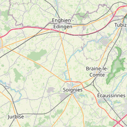


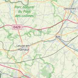
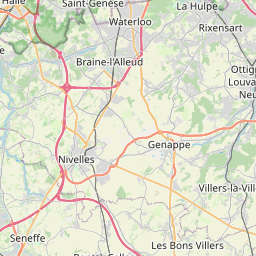


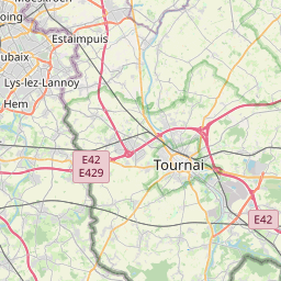
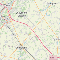

Leaflet | © OpenStreetMap
How far is it between Leuven and Ronse
Leuven is located in Belgium with (50.8796,4.7009) coordinates and Ronse is located in Belgium with (50.7457,3.6005) coordinates. The calculated flying distance from Leuven to Ronse is equal to 49 miles which is equal to 79 km.
If you want to go by car, the driving distance between Leuven and Ronse is 119.7 km. If you ride your car with an average speed of 112 kilometers/hour (70 miles/h), travel time will be 01 hours 04 minutes. Please check the avg. speed travel time table on the right for various options.
Difference between fly and go by a car is 41 km.
| City/Place | Latitude and Longitude | GPS Coordinates |
|---|---|---|
| Leuven | 50.8796, 4.7009 | 50° 52´ 46.5240'' N 4° 42´ 3.3480'' E |
| Ronse | 50.7457, 3.6005 | 50° 44´ 44.6640'' N 3° 36´ 1.8000'' E |
Estimated Travel Time Between Leuven and Ronse
| Average Speed | Travel Time |
|---|---|
| 30 mph (48 km/h) | 02 hours 29 minutes |
| 40 mph (64 km/h) | 01 hours 52 minutes |
| 50 mph (80 km/h) | 01 hours 29 minutes |
| 60 mph (97 km/h) | 01 hours 14 minutes |
| 70 mph (112 km/h) | 01 hours 04 minutes |
| 75 mph (120 km/h) | 00 hours 59 minutes |
Leuven, , Belgium
Related Distances from Leuven
| Cities | Distance |
|---|---|
| Leuven to Mechelen | 39 km |
| Leuven to Tienen | 20 km |
| Leuven to Turnhout | 102 km |
| Leuven to Zaventem | 21 km |
| Leuven to Mol | 79 km |
Ronse, , Belgium
Related Distances to Ronse
| Cities | Distance |
|---|---|
| Gent to Ronse | 42 km |
| Lier to Ronse | 128 km |
| Hamme to Ronse | 74 km |
| Antwerpen to Ronse | 93 km |
| Leuven to Ronse | 120 km |