Distance from Lexington to Aiken
Distance between Lexington and Aiken is 65 kilometers (40 miles).
Driving distance from Lexington to Aiken is 69 kilometers (43 miles).
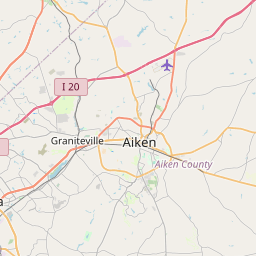
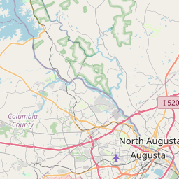
Distance Map Between Lexington and Aiken
Lexington, Columbia, United States ↔ Aiken, Columbia, United States = 40 miles = 65 km.
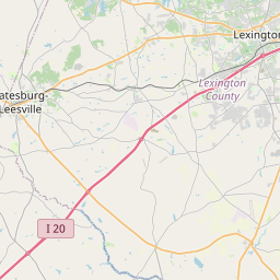

How far is it between Lexington and Aiken
Lexington is located in United States with (33.9815,-81.2362) coordinates and Aiken is located in United States with (33.5604,-81.7196) coordinates. The calculated flying distance from Lexington to Aiken is equal to 40 miles which is equal to 65 km.
If you want to go by car, the driving distance between Lexington and Aiken is 68.83 km. If you ride your car with an average speed of 112 kilometers/hour (70 miles/h), travel time will be 00 hours 36 minutes. Please check the avg. speed travel time table on the right for various options.
Difference between fly and go by a car is 4 km.
| City/Place | Latitude and Longitude | GPS Coordinates |
|---|---|---|
| Lexington | 33.9815, -81.2362 | 33° 58´ 53.5440'' N 81° 14´ 10.3560'' W |
| Aiken | 33.5604, -81.7196 | 33° 33´ 37.5120'' N 81° 43´ 10.3800'' W |
Estimated Travel Time Between Lexington and Aiken
| Average Speed | Travel Time |
|---|---|
| 30 mph (48 km/h) | 01 hours 26 minutes |
| 40 mph (64 km/h) | 01 hours 04 minutes |
| 50 mph (80 km/h) | 00 hours 51 minutes |
| 60 mph (97 km/h) | 00 hours 42 minutes |
| 70 mph (112 km/h) | 00 hours 36 minutes |
| 75 mph (120 km/h) | 00 hours 34 minutes |
Related Distances from Lexington
| Cities | Distance |
|---|---|
| Lexington 4 to Aiken | 69 km |
| Lexington 4 to Anderson 2 | 195 km |
| Lexington 4 to Charleston | 191 km |
| Lexington 4 to Conway 2 | 240 km |
| Lexington 4 to Easley | 190 km |
| Lexington 4 to Florence 3 | 151 km |
| Lexington 4 to Goose Creek | 171 km |
| Lexington 4 to Greenville 2 | 173 km |
| Lexington 4 to Greenwood 2 | 99 km |
| Lexington 4 to Greer | 179 km |
Related Distances to Aiken
| Cities | Distance |
|---|---|
| Seven Oaks to Aiken | 83 km |
| Hilton Head Island to Aiken | 203 km |
| Simpsonville to Aiken | 162 km |
| Mount Pleasant to Aiken | 219 km |
| Conway 2 to Aiken | 306 km |
| North Charleston to Aiken | 202 km |
| Spartanburg to Aiken | 173 km |
| Goose Creek to Aiken | 188 km |
| Florence 3 to Aiken | 216 km |
| Rock Hill to Aiken | 194 km |