Distance from Limbdi to Sihor
Distance between Limbdi and Sihor is 96 kilometers (60 miles).
Driving distance from Limbdi to Sihor is 113 kilometers (70 miles).
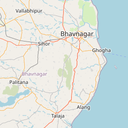
Distance Map Between Limbdi and Sihor
Limbdi, Ghandinagar, India ↔ Sihor, Ghandinagar, India = 60 miles = 96 km.


How far is it between Limbdi and Sihor
Limbdi is located in India with (22.5651,71.8108) coordinates and Sihor is located in India with (21.7113,71.9618) coordinates. The calculated flying distance from Limbdi to Sihor is equal to 60 miles which is equal to 96 km.
If you want to go by car, the driving distance between Limbdi and Sihor is 112.55 km. If you ride your car with an average speed of 112 kilometers/hour (70 miles/h), travel time will be 01 hours 00 minutes. Please check the avg. speed travel time table on the right for various options.
Difference between fly and go by a car is 17 km.
| City/Place | Latitude and Longitude | GPS Coordinates |
|---|---|---|
| Limbdi | 22.5651, 71.8108 | 22° 33´ 54.2520'' N 71° 48´ 38.7360'' E |
| Sihor | 21.7113, 71.9618 | 21° 42´ 40.8240'' N 71° 57´ 42.4440'' E |
Estimated Travel Time Between Limbdi and Sihor
| Average Speed | Travel Time |
|---|---|
| 30 mph (48 km/h) | 02 hours 20 minutes |
| 40 mph (64 km/h) | 01 hours 45 minutes |
| 50 mph (80 km/h) | 01 hours 24 minutes |
| 60 mph (97 km/h) | 01 hours 09 minutes |
| 70 mph (112 km/h) | 01 hours 00 minutes |
| 75 mph (120 km/h) | 00 hours 56 minutes |
Related Distances from Limbdi
| Cities | Distance |
|---|---|
| Limbdi to Rajkot | 117 km |
| Limbdi to Surendranagar | 27 km |
| Limbdi to Sayla | 37 km |
| Limbdi to Morbi | 138 km |
| Limbdi to Than | 87 km |
Related Distances to Sihor
| Cities | Distance |
|---|---|
| Bhavnagar to Sihor | 24 km |
| Jabalpur to Sihora | 42 km |
| Sagar to Sihora | 170 km |
| Chhindwara to Sihora | 251 km |
| Rajkot to Sihor | 152 km |