Distance from Limoeiro to Olinda
Distance between Limoeiro and Olinda is 67 kilometers (42 miles).
Driving distance from Limoeiro to Olinda is 93 kilometers (58 miles).
Distance Map Between Limoeiro and Olinda
Limoeiro, Recife, Brazil ↔ Olinda, Recife, Brazil = 42 miles = 67 km.


How far is it between Limoeiro and Olinda
Limoeiro is located in Brazil with (-7.8747,-35.4503) coordinates and Olinda is located in Brazil with (-8.0089,-34.8553) coordinates. The calculated flying distance from Limoeiro to Olinda is equal to 42 miles which is equal to 67 km.
If you want to go by car, the driving distance between Limoeiro and Olinda is 93.29 km. If you ride your car with an average speed of 112 kilometers/hour (70 miles/h), travel time will be 00 hours 49 minutes. Please check the avg. speed travel time table on the right for various options.
Difference between fly and go by a car is 26 km.
| City/Place | Latitude and Longitude | GPS Coordinates |
|---|---|---|
| Limoeiro | -7.8747, -35.4503 | 7° 52´ 28.9920'' S 35° 27´ 1.0080'' W |
| Olinda | -8.0089, -34.8553 | 8° 0´ 32.0040'' S 34° 51´ 19.0080'' W |
Estimated Travel Time Between Limoeiro and Olinda
| Average Speed | Travel Time |
|---|---|
| 30 mph (48 km/h) | 01 hours 56 minutes |
| 40 mph (64 km/h) | 01 hours 27 minutes |
| 50 mph (80 km/h) | 01 hours 09 minutes |
| 60 mph (97 km/h) | 00 hours 57 minutes |
| 70 mph (112 km/h) | 00 hours 49 minutes |
| 75 mph (120 km/h) | 00 hours 46 minutes |
Related Distances from Limoeiro
| Cities | Distance |
|---|---|
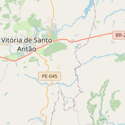
| Limoeiro to Vitoria De Santo Antao | 44 km |
| Limoeiro to Palmares | 140 km |
| Limoeiro to Nazare Da Mata | 38 km |
| Limoeiro to Tabira | 308 km |
| Limoeiro to Sao Jose Do Egito | 275 km |
Related Distances to Olinda
| Cities | Distance |
|---|---|
| Goiana to Olinda | 58 km |
| Bom Conselho to Olinda | 281 km |
| Gloria Do Goita to Olinda | 69 km |
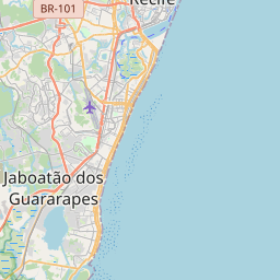
| Jaboatao Dos Guararapes to Olinda | 26 km |
| Gameleira to Olinda | 102 km |