Distance from London to Charlottenlund
Distance between London and Charlottenlund is 960 kilometers (597 miles).
Driving distance from London to Charlottenlund is 1272 kilometers (790 miles).
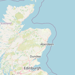
Distance Map Between London and Charlottenlund
London, United Kingdom ↔ Charlottenlund, Copenhagen, Denmark = 597 miles = 960 km.


How far is it between London and Charlottenlund
London is located in United Kingdom with (51.5085,-0.1257) coordinates and Charlottenlund is located in Denmark with (55.7537,12.5918) coordinates. The calculated flying distance from London to Charlottenlund is equal to 597 miles which is equal to 960 km.
If you want to go by car, the driving distance between London and Charlottenlund is 1271.82 km. If you ride your car with an average speed of 112 kilometers/hour (70 miles/h), travel time will be 11 hours 21 minutes. Please check the avg. speed travel time table on the right for various options.
Difference between fly and go by a car is 312 km.
| City/Place | Latitude and Longitude | GPS Coordinates |
|---|---|---|
| London | 51.5085, -0.1257 | 51° 30´ 30.7080'' N 0° 7´ 32.6640'' W |
| Charlottenlund | 55.7537, 12.5918 | 55° 45´ 13.2120'' N 12° 35´ 30.5160'' E |
Estimated Travel Time Between London and Charlottenlund
| Average Speed | Travel Time |
|---|---|
| 30 mph (48 km/h) | 26 hours 29 minutes |
| 40 mph (64 km/h) | 19 hours 52 minutes |
| 50 mph (80 km/h) | 15 hours 53 minutes |
| 60 mph (97 km/h) | 13 hours 06 minutes |
| 70 mph (112 km/h) | 11 hours 21 minutes |
| 75 mph (120 km/h) | 10 hours 35 minutes |
Related Distances from London
| Cities | Distance |
|---|---|
| London to Copenhagen | 1263 km |
| London to Aalborg | 1364 km |
| London to Esbjerg | 1192 km |
| London to Odense | 1219 km |
| London to Kolding | 1162 km |
Related Distances to Charlottenlund
| Cities | Distance |
|---|---|
| London to Charlottenlund | 1272 km |
| City Of London to Charlottenlund | 1269 km |