Distance from Lubbock to Bedford
Distance between Lubbock and Bedford is 446 kilometers (277 miles).
Driving distance from Lubbock to Bedford is 528 kilometers (328 miles).
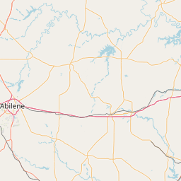
Distance Map Between Lubbock and Bedford
Lubbock, Austin, United States ↔ Bedford, Austin, United States = 277 miles = 446 km.


How far is it between Lubbock and Bedford
Lubbock is located in United States with (33.5779,-101.8552) coordinates and Bedford is located in United States with (32.844,-97.1431) coordinates. The calculated flying distance from Lubbock to Bedford is equal to 277 miles which is equal to 446 km.
If you want to go by car, the driving distance between Lubbock and Bedford is 528.49 km. If you ride your car with an average speed of 112 kilometers/hour (70 miles/h), travel time will be 04 hours 43 minutes. Please check the avg. speed travel time table on the right for various options.
Difference between fly and go by a car is 82 km.
| City/Place | Latitude and Longitude | GPS Coordinates |
|---|---|---|
| Lubbock | 33.5779, -101.8552 | 33° 34´ 40.2960'' N 101° 51´ 18.6120'' W |
| Bedford | 32.844, -97.1431 | 32° 50´ 38.4720'' N 97° 8´ 35.0520'' W |
Estimated Travel Time Between Lubbock and Bedford
| Average Speed | Travel Time |
|---|---|
| 30 mph (48 km/h) | 11 hours 00 minutes |
| 40 mph (64 km/h) | 08 hours 15 minutes |
| 50 mph (80 km/h) | 06 hours 36 minutes |
| 60 mph (97 km/h) | 05 hours 26 minutes |
| 70 mph (112 km/h) | 04 hours 43 minutes |
| 75 mph (120 km/h) | 04 hours 24 minutes |
Related Distances from Lubbock
| Cities | Distance |
|---|---|
| Lubbock to Dallas | 556 km |
| Lubbock to San Antonio | 619 km |
| Lubbock to Houston | 838 km |
| Lubbock to Abilene | 269 km |
| Lubbock to Amarillo | 199 km |
Related Distances to Bedford
| Cities | Distance |
|---|---|
| Irving to Bedford 2 | 21 km |
| Mckinney to Bedford 2 | 73 km |
| Dallas to Bedford 2 | 36 km |
| Fort Worth to Bedford 2 | 30 km |
| Portland 3 to Bedford 2 | 636 km |