Distance from Lumbang to Malanday
Distance between Lumbang and Malanday is 58 kilometers (36 miles).
Driving distance from Lumbang to Malanday is 89 kilometers (55 miles).
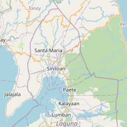
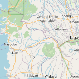
Distance Map Between Lumbang and Malanday
Lumbang, Calamba, Philippines ↔ Malanday, Calamba, Philippines = 36 miles = 58 km.


How far is it between Lumbang and Malanday
Lumbang is located in Philippines with (14.2973,121.4598) coordinates and Malanday is located in Philippines with (14.7069,121.1306) coordinates. The calculated flying distance from Lumbang to Malanday is equal to 36 miles which is equal to 58 km.
If you want to go by car, the driving distance between Lumbang and Malanday is 88.7 km. If you ride your car with an average speed of 112 kilometers/hour (70 miles/h), travel time will be 00 hours 47 minutes. Please check the avg. speed travel time table on the right for various options.
Difference between fly and go by a car is 31 km.
| City/Place | Latitude and Longitude | GPS Coordinates |
|---|---|---|
| Lumbang | 14.2973, 121.4598 | 14° 17´ 50.2800'' N 121° 27´ 35.2800'' E |
| Malanday | 14.7069, 121.1306 | 14° 42´ 24.8400'' N 121° 7´ 50.1600'' E |
Estimated Travel Time Between Lumbang and Malanday
| Average Speed | Travel Time |
|---|---|
| 30 mph (48 km/h) | 01 hours 50 minutes |
| 40 mph (64 km/h) | 01 hours 23 minutes |
| 50 mph (80 km/h) | 01 hours 06 minutes |
| 60 mph (97 km/h) | 00 hours 54 minutes |
| 70 mph (112 km/h) | 00 hours 47 minutes |
| 75 mph (120 km/h) | 00 hours 44 minutes |
Related Distances from Lumbang
| Cities | Distance |
|---|---|
| Lumbang to Talisay 3 | 66 km |
| Lumbang to Taguig | 91 km |
| Lumbang to Santo Tomas | 51 km |
| Lumbang to Maragondon | 114 km |
| Lumbang to Taal | 101 km |
Related Distances to Malanday
| Cities | Distance |
|---|---|
| Batangas to Malanday | 127 km |
| Binangonan to Malanday | 34 km |
| Banaybanay to Malanday | 124 km |
| Candelaria to Malanday | 126 km |
| Lucban to Malanday | 135 km |