Distance from Lusaka to Serowe
Distance between Lusaka and Serowe is 794 kilometers (493 miles).
Driving distance from Lusaka to Serowe is 1239 kilometers (770 miles).
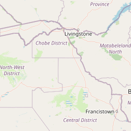
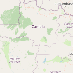
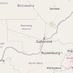
Distance Map Between Lusaka and Serowe
Lusaka, Zambia ↔ Serowe, Botswana = 493 miles = 794 km.


How far is it between Lusaka and Serowe
Lusaka is located in Zambia with (-15.4067,28.2871) coordinates and Serowe is located in Botswana with (-22.3875,26.7108) coordinates. The calculated flying distance from Lusaka to Serowe is equal to 493 miles which is equal to 794 km.
If you want to go by car, the driving distance between Lusaka and Serowe is 1239.11 km. If you ride your car with an average speed of 112 kilometers/hour (70 miles/h), travel time will be 11 hours 03 minutes. Please check the avg. speed travel time table on the right for various options.
Difference between fly and go by a car is 445 km.
| City/Place | Latitude and Longitude | GPS Coordinates |
|---|---|---|
| Lusaka | -15.4067, 28.2871 | 15° 24´ 24.0840'' S 28° 17´ 13.6680'' E |
| Serowe | -22.3875, 26.7108 | 22° 23´ 15.1440'' S 26° 42´ 38.7720'' E |
Estimated Travel Time Between Lusaka and Serowe
| Average Speed | Travel Time |
|---|---|
| 30 mph (48 km/h) | 25 hours 48 minutes |
| 40 mph (64 km/h) | 19 hours 21 minutes |
| 50 mph (80 km/h) | 15 hours 29 minutes |
| 60 mph (97 km/h) | 12 hours 46 minutes |
| 70 mph (112 km/h) | 11 hours 03 minutes |
| 75 mph (120 km/h) | 10 hours 19 minutes |
Related Distances from Lusaka
| Cities | Distance |
|---|---|
| Lusaka to Gaborone | 1466 km |
| Lusaka to Francistown | 1031 km |
| Lusaka to Maun | 1147 km |
| Lusaka to Kanye | 1553 km |
| Lusaka to Palapye | 1199 km |