Distance from Madrid to Pacho
Distance between Madrid and Pacho is 46 kilometers (29 miles).
Driving distance from Madrid to Pacho is 97 kilometers (60 miles).
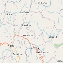
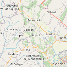
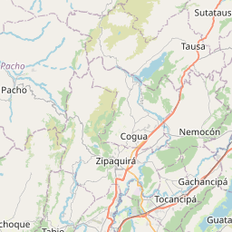
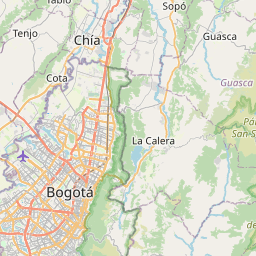
Distance Map Between Madrid and Pacho
Madrid, , Colombia ↔ Pacho, , Colombia = 29 miles = 46 km.


How far is it between Madrid and Pacho
Madrid is located in Colombia with (4.7325,-74.2642) coordinates and Pacho is located in Colombia with (5.1328,-74.1598) coordinates. The calculated flying distance from Madrid to Pacho is equal to 29 miles which is equal to 46 km.
If you want to go by car, the driving distance between Madrid and Pacho is 96.79 km. If you ride your car with an average speed of 112 kilometers/hour (70 miles/h), travel time will be 00 hours 51 minutes. Please check the avg. speed travel time table on the right for various options.
Difference between fly and go by a car is 51 km.
| City/Place | Latitude and Longitude | GPS Coordinates |
|---|---|---|
| Madrid | 4.7325, -74.2642 | 4° 43´ 56.8200'' N 74° 15´ 51.0840'' W |
| Pacho | 5.1328, -74.1598 | 5° 7´ 58.0080'' N 74° 9´ 35.1720'' W |
Estimated Travel Time Between Madrid and Pacho
| Average Speed | Travel Time |
|---|---|
| 30 mph (48 km/h) | 02 hours 00 minutes |
| 40 mph (64 km/h) | 01 hours 30 minutes |
| 50 mph (80 km/h) | 01 hours 12 minutes |
| 60 mph (97 km/h) | 00 hours 59 minutes |
| 70 mph (112 km/h) | 00 hours 51 minutes |
| 75 mph (120 km/h) | 00 hours 48 minutes |
Related Distances from Madrid
| Cities | Distance |
|---|---|
| Madrid 2 to Mosquera | 5 km |
| Madrid 2 to Pacho | 97 km |
| Madrid 2 to Sibate | 40 km |
| Madrid 2 to Soacha | 36 km |
| Madrid 2 to Villeta | 61 km |
| Madrid 2 to Zipaquira | 57 km |
Related Distances to Pacho
| Cities | Distance |
|---|---|
| Cajica to Pacho | 50 km |
| Fusagasuga to Pacho | 156 km |
| Mosquera to Pacho | 91 km |
| Soacha to Pacho | 105 km |
| Zipaquira to Pacho | 40 km |
| Girardot City to Pacho | 221 km |
| Funza to Pacho | 89 km |
| Facatativa to Pacho | 86 km |
| Madrid 2 to Pacho | 97 km |