Distance from Magarao to Guangzhou
Distance between Magarao and Guangzhou is 1484 kilometers (922 miles).
Distance Map Between Magarao and Guangzhou
Magarao, Legaspi, Philippines ↔ Guangzhou, China = 922 miles = 1484 km.


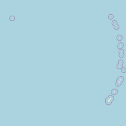


Leaflet | © OpenStreetMap
How far is it between Magarao and Guangzhou
Magarao is located in Philippines with (13.6604,123.1869) coordinates and Guangzhou is located in China with (23.1167,113.25) coordinates. The calculated flying distance from Magarao to Guangzhou is equal to 922 miles which is equal to 1484 km.
| City/Place | Latitude and Longitude | GPS Coordinates |
|---|---|---|
| Magarao | 13.6604, 123.1869 | 13° 39´ 37.4400'' N 123° 11´ 12.8400'' E |
| Guangzhou | 23.1167, 113.25 | 23° 7´ 0.0120'' N 113° 15´ 0.0000'' E |
Magarao, Legaspi, Philippines
Related Distances from Magarao
| Cities | Distance |
|---|---|
| Magarao to Naga | 7 km |
| Magarao to Sorsogon | 148 km |
| Magarao to Polangui | 60 km |
| Magarao to Virac | 172 km |
| Magarao to Nabua | 40 km |
Guangzhou, China
Related Distances to Guangzhou
| Cities | Distance |
|---|---|
| Beijing to Guangzhou | 2160 km |
| Shenzhen to Guangzhou | 147 km |
| Shanghai to Guangzhou | 1508 km |
| Chengdu to Guangzhou | 1729 km |
| Chongqing to Guangzhou | 1459 km |