Distance from Maham to Narnaund
Distance between Maham and Narnaund is 32 kilometers (20 miles).
Driving distance from Maham to Narnaund is 44 kilometers (27 miles).
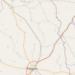
Distance Map Between Maham and Narnaund
Maham, , India ↔ Narnaund, , India = 20 miles = 32 km.


How far is it between Maham and Nārnaund
Maham is located in India with (28.968,76.2954) coordinates and Narnaund is located in India with (29.2212,76.1417) coordinates. The calculated flying distance from Maham to Narnaund is equal to 20 miles which is equal to 32 km.
If you want to go by car, the driving distance between Maham and Narnaund is 43.7 km. If you ride your car with an average speed of 112 kilometers/hour (70 miles/h), travel time will be 00 hours 23 minutes. Please check the avg. speed travel time table on the right for various options.
Difference between fly and go by a car is 12 km.
| City/Place | Latitude and Longitude | GPS Coordinates |
|---|---|---|
| Maham | 28.968, 76.2954 | 28° 58´ 4.6920'' N 76° 17´ 43.3680'' E |
| Narnaund | 29.2212, 76.1417 | 29° 13´ 16.4280'' N 76° 8´ 30.1560'' E |
Estimated Travel Time Between Maham and Nārnaund
| Average Speed | Travel Time |
|---|---|
| 30 mph (48 km/h) | 00 hours 54 minutes |
| 40 mph (64 km/h) | 00 hours 40 minutes |
| 50 mph (80 km/h) | 00 hours 32 minutes |
| 60 mph (97 km/h) | 00 hours 27 minutes |
| 70 mph (112 km/h) | 00 hours 23 minutes |
| 75 mph (120 km/h) | 00 hours 21 minutes |
Related Distances from Maham
| Cities | Distance |
|---|---|
| Maham to Rohtak | 33 km |
| Maham to Rewari | 103 km |
| Maham to Mahendragarh | 91 km |
| Maham to Narnaul | 116 km |
| Maham to Safidon | 81 km |
Related Distances to Narnaund
| Cities | Distance |
|---|---|
| Hisar to Narnaund | 49 km |
| Jind to Narnaund | 22 km |
| Hansi to Narnaund | 23 km |
| Barwala to Narnaund | 34 km |
| Bhiwani to Narnaund | 58 km |